When Is a Topographic Survey Considered "Out of Date"?

Your Survey Might Be Costing You More Than You Think
If you are a property developer, architect, engineer, or landowner, you will know that a topographic survey is one of the most important documents you can have when planning a project.
It provides a detailed snapshot of existing site conditions, capturing natural and man-made features such as contours, buildings, boundaries, trees, roads, and drainage. But here is the question that catches many professionals off guard: when does that snapshot stop being reliable?
At SUMO Services, we regularly speak with clients who assume that a topographic survey completed a few years ago is still perfectly usable. In some cases, it might be. In many others, however, site conditions have changed enough to render the data inaccurate, potentially leading to planning application delays, costly redesigns, or even disputes on site. In this guide, we will walk you through exactly when a topographic survey is considered out of date, what triggers the need for a new one, and how to protect your project from the risks of relying on outdated information.
Does a Topographic Survey Have an Expiry Date?
Strictly speaking, a topographic survey does not come with a formal expiry date in the way a passport or driving licence does. There is no single regulation in the UK that states a land survey must be renewed after a fixed number of years. However, that does not mean your survey data remains accurate indefinitely.
The practical lifespan of a topographical survey depends on what has happened on and around the site since the survey was completed. Industry best practice generally suggests that a topographic survey should be considered for review after two to three years, even if no obvious changes have occurred. For sites in active development areas or urban environments, the window can be even shorter. The key principle is simple: a survey is only as reliable as the conditions it was designed to capture.
It is worth noting that bodies such as the Royal Institution of Chartered Surveyors (RICS) provide professional guidance and standards for surveyors across the UK. While these standards do not set a rigid expiry for topographic surveys, they do emphasise the importance of accuracy and currency of data in professional surveying practice.
What Makes a Topographic Survey Out of Date?
Several common triggers can make your existing topographic survey unreliable. Understanding these will help you assess whether your current data is still fit for purpose.
Physical Changes to the Site
This is the most obvious trigger. If any of the following have occurred since your last survey, your data is likely out of date:
New structures have been built, including extensions, outbuildings, fences, walls, or temporary buildings. Trees have been felled or new planting has taken place. Ground levels have changed due to earthworks, landscaping, or natural erosion. Existing buildings or features have been demolished or removed. Hard surfaces such as car parks, driveways, or pathways have been added or altered.
Even relatively minor changes to ground levels or surface features can have a significant impact on drainage design, foundation planning, and site layout. When you are working with contour data, accuracy matters down to the centimetre.
Changes to Neighbouring Land
Your site does not exist in isolation. Developments on adjacent land can affect your project in ways that an old survey simply will not reflect. Neighbouring construction, new boundary treatments, altered access routes, or changes in drainage patterns on adjoining plots can all influence the design and viability of your scheme. If the land around your site has changed, it is worth commissioning an updated topographic survey to capture the full picture.
Utility and Infrastructure Updates
Below-ground services and utilities can change significantly over time. New mains connections, diverted pipelines, upgraded cabling, or additional drainage runs may have been installed since your original survey. This is where a utility survey becomes essential, particularly one carried out in accordance with PAS 128, the UK standard for underground utility detection and mapping. A PAS 128 survey ensures that underground services are detected, verified, and accurately mapped, helping to reduce the risk of costly service strikes during construction.
At SUMO, we offer both topographic and utility surveys, giving you full visibility above and below the ground from a single survey provider. This combined approach is one of the most effective ways to ensure your site data is current and comprehensive.
Changes in Planning Policy or Local Requirements
Planning authorities across the UK regularly update their local development frameworks, supplementary planning documents, and validation checklists. What was acceptable as supporting survey information for a planning application a few years ago may no longer meet current requirements. Some local planning authorities now expect more detailed survey data as part of the validation process, particularly for sites in flood risk zones, conservation areas, or near protected habitats. As outlined in the GOV.UK planning application guidance, applications must be accompanied by accurate plans and drawings, and submitting outdated survey data could lead to delays or even refusal.
If your planning permission survey data does not reflect the current state of the site, your application may be returned as invalid, costing you valuable time and money.
How Outdated Survey Data Can Derail Your Project
Relying on an out-of-date topographic survey is not just a minor inconvenience. It can create a chain of problems that ripple through every stage of your project, from planning through to construction.
Planning Application Delays
Local planning authorities expect submitted drawings to accurately represent existing site conditions. If your survey data is old, the site plan, sections, and levels shown on your application drawings may not match what the planning officer sees on a site visit. This discrepancy can trigger requests for additional information, formal objections, or outright refusal. For projects operating on tight timescales, these planning application delays can push back start dates by weeks or even months.
Design and Engineering Errors
Architects and engineers rely on survey data to design foundations, drainage systems, road layouts, and building positions. If the contour data, spot levels, or feature positions are wrong because the survey is outdated, designs may not work when applied to the actual site. This can lead to expensive redesigns, variations during construction, and disputes between project team members.
Construction Cost Overruns
When a construction site survey does not match reality, contractors may encounter unexpected ground conditions, uncharted services, or features that were not shown on the drawings. Each of these surprises adds cost and delay. In the worst cases, work may need to stop entirely while a new survey is commissioned and designs are revised. It is far more cost-effective to invest in an updated measured land survey before construction begins than to deal with the consequences of working from inaccurate data.
Boundary Disputes
An outdated boundary survey can lead to significant legal and practical problems. If boundary features such as fences, walls, or hedges have been moved or replaced since the original survey, the recorded boundary positions may no longer be accurate. This can cause disputes with neighbours, complications during land transactions, and difficulties with title registration. Ensuring that your survey accurately reflects current boundary positions is essential for any land development survey.
When Should You Commission a New Topographic Survey?
As a general rule, we recommend updating your topographic survey data in any of the following situations:
Any physical changes have occurred on or around the site. You are submitting a new planning application or revising an existing one. You are moving from the planning stage into detailed design or pre-construction. The site is in an area of active development where neighbouring land may have changed. You need to incorporate below-ground utility data and your existing survey does not include a PAS 128 utility survey. You are buying or selling land and need to confirm existing conditions for due diligence purposes.
For pre-construction surveys specifically, having current and accurate data is not just advisable but essential. The transition from planning to construction is the point at which any inaccuracies in your survey data will be exposed, often at considerable cost.
How SUMO Services Can Help
At SUMO Services, we understand the importance of delivering survey data that is clear and accurate. Our strategically located survey teams throughout the UK mean we can respond quickly to your requirements, whether you need a new topographic survey, a utility survey, a measured building survey, or a combination of services.
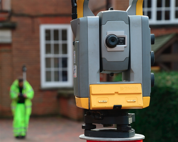
We use the latest Trimble robotic total stations and GPS surveying units to deliver top-quality, full-colour survey drawings. Our post-survey support includes a detailed explanation of survey results, so you understand exactly what the data is telling you. And because we offer a comprehensive suite of survey services from one company, you benefit from a streamlined process, competitive pricing, and a single point of contact for all your survey needs.
Whether you need a construction site survey for a major development, an existing conditions survey for a planning application, or a laser scanning and 3D survey for a complex site, we have the expertise and equipment to deliver.
The Bottom Line: Do Not Let Old Data Cost You
A topographic survey is a snapshot of a moment in time. The longer you wait to use that data, the greater the risk that it no longer reflects reality. While there is no legal expiry date for a land survey in the UK, the practical risks of relying on outdated information are real and significant. From planning application delays to construction cost overruns and boundary disputes, the consequences of using an old survey can far outweigh the cost of commissioning a new one.
The safest approach is to treat your survey data as time-sensitive. Review it regularly, update it before key project milestones, and always ensure it reflects the current state of the site before making decisions based on it.
Frequently Asked Questions
How long is a topographic survey valid for?
There is no fixed legal validity period for a topographic survey in the UK. However, industry best practice suggests reviewing your survey data every two to three years. If any changes have occurred on or around the site, or if you are submitting a new planning application, it is wise to commission an updated survey regardless of age.
Do topographic surveys expire?
Topographic surveys do not formally expire. However, they can become unreliable if site conditions change. Physical alterations to the land, new construction on neighbouring plots, utility upgrades, or changes in planning requirements can all render an existing survey inaccurate.
What is a PAS 128 survey and why does it matter?
A PAS 128 survey is carried out in accordance with the UK standard for underground utility detection and mapping. It ensures that below-ground services such as water, gas, electric, and telecoms are accurately located and recorded. Combining a PAS 128 utility survey with a topographic survey gives you full visibility of the site above and below ground.
Can I use an old survey for a new planning application?
You can, but it is risky. If the survey does not accurately reflect current site conditions, the planning authority may return your application as invalid or request additional information. This can cause significant delays. We always recommend using current survey data for any planning submission.
What is the difference between a topographic survey and a boundary survey?
A topographic survey captures the physical features, levels, and contours of a site, while a boundary survey focuses specifically on defining the legal and physical boundaries of a property. Both types of survey are important for land development, and both can become outdated if site conditions change.
How quickly can SUMO carry out a new topographic survey?
We pride ourselves on speed from first enquiry to quotation and can typically mobilise survey teams quickly thanks to our strategically located offices throughout the UK. The exact timeline depends on the size and complexity of the site, but we will always work with you to meet your project deadlines. Request a free survey quotation to get started.
Ready to Update Your Survey Data? Let Us Help
If you are unsure whether your topographic survey is still fit for purpose, or if you know it is time for an update, we are here to help. At SUMO Services, we make the process straightforward, from your initial enquiry right through to delivering clear, accurate survey data you can rely on.
Get in touch with our team today by emailing info@sumoservices.com or visit our contact page to request your free survey quotation. Let us take the guesswork out of your next project.