


How Topographic Surveys Support Urban & Brownfield Developments
If you are planning a development on a brownfield site or within an urban setting, there is one step that can make or break the entire project: a thorough topographic survey.
From uncovering hidden hazards to supporting your planning application, topographic surveys form the backbone of intelligent, risk-aware development. In this guide, we explore exactly how topographic surveys support urban and brownfield developments, and why commissioning one early can save you significant time, money and stress.
What Is a Topographic Survey and What Does It Capture?
A topographic survey is a detailed assessment of the physical features, contours and elevations of a given piece of land. It captures both natural and man-made features, including ground levels, buildings, roads, trees, fences, drainage features, embankments and boundary lines. The resulting data is used to produce accurate topographic mapping, typically delivered as CAD drawings, digital terrain models and contour plans.
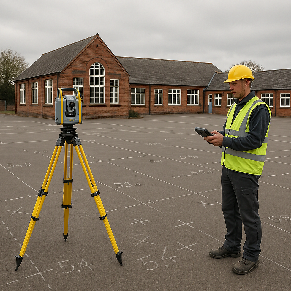
At SUMO Services, our survey engineers use the latest Trimble robotic total stations and GPS surveying units to deliver survey data that is clear, accurate and ready for use in your design and planning workflows. Whether you need a measured survey for a compact urban plot or a large-scale site survey across a brownfield development, the goal is the same: to give your project team a precise picture of existing site conditions before any design work begins.
These surveys go well beyond a simple site sketch. They record spot levels, ground contours, tree positions (including canopy spreads), overhead cables, manholes, service covers and any visible evidence of past land use. This level of detail is what sets a professional topographic survey apart and makes it such a valuable tool for developers, architects and engineers.
Why Topographic Surveys Matter for Brownfield and Urban Sites
Brownfield land presents a unique set of challenges that greenfield sites simply do not. Previously developed land may contain remnants of former structures, buried foundations, underground tanks, contaminated ground and redundant utility networks. This is why using SUMO’s Geophysics department combined with a topographic survey can find these potential buried remnants. Urban sites add further complexity through restricted access, neighbouring structures, live services and tight boundaries.
A topographic survey is the first step in understanding these constraints. By mapping existing conditions in detail, your design team can identify potential obstacles early, long before they become costly surprises on site. This is particularly important for brownfield development, where the history of previous use means that the ground may hold more than meets the eye.
For urban regeneration projects, a topographic survey helps ensure that new development integrates smoothly with the surrounding built environment. Accurate data on adjacent buildings, kerb lines, street furniture and access points allows architects and planners to design schemes that respect the existing urban fabric while making the most of available space.
Brownfield Site Surveys: Uncovering What Lies Beneath
One of the greatest risks on any brownfield site is the unknown. Former industrial use, old fuel storage, buried services and abandoned foundations can all create problems during construction if they are not identified and addressed in advance. A thorough brownfield site survey, combining topographic mapping with complementary services such as utility surveys and geophysical engineering surveys, provides a comprehensive picture of both above and below ground conditions.
At SUMO, we provide a fully integrated answer to your survey problems, covering both above and below ground profiling from a single survey company. This integrated approach is particularly valuable on brownfield sites, where the interaction between surface features and buried infrastructure can directly influence your development strategy.
Our buried tank detection case study is a good example of how combining survey techniques on previously developed land can reveal hazards that would otherwise go undetected until the construction phase.
Supporting Planning Permission and Regulatory Compliance
Accurate topographic data plays a critical role in securing planning permission. Local planning authorities require detailed site plans and sections as part of any application, and a professional topographic survey provides the baseline data needed to produce these documents.
The UK Government's National Planning Policy Framework (NPPF) places substantial weight on the effective use of brownfield land, encouraging local authorities to support appropriate redevelopment of previously developed sites. To take advantage of this policy direction, developers need to demonstrate a thorough understanding of their site, and that starts with a comprehensive development survey.
For sites in flood-risk areas, topographic survey data feeds directly into the flood risk assessment process. The UK Government's guidance on flood risk assessments makes clear that planning applicants may need to carry out a flood risk assessment, and accurate ground level data from a topographic survey is essential for this work.
Beyond planning, topographic surveys also support compliance with building regulations, ecological assessments and environmental impact requirements. When combined with measured building surveys, they provide a complete spatial record that supports every stage of the regulatory process.
Flood Risk, Drainage and Stormwater Planning
Flood risk and drainage design are critical considerations for any urban or brownfield development. Brownfield sites in particular may have altered drainage patterns due to previous development, with compacted ground, buried hardstanding and legacy drainage networks all affecting how water moves across and through the site.
A topographic survey captures the detailed ground levels and contour data that drainage engineers need to model surface water flow, design sustainable drainage systems (SuDS) and demonstrate compliance with local authority requirements. Without accurate elevation data, it is impossible to design drainage solutions that work effectively and meet regulatory standards.
For urban developments, where impermeable surfaces are common and space for drainage infrastructure is limited, having precise topographic data is even more important. It allows engineers to optimise gradients, identify low points where water may collect and plan appropriate attenuation measures.
Survey Methods and Technology for Urban and Brownfield Sites
Modern topographic surveys draw on a range of technologies to capture data efficiently and accurately. The choice of method depends on the size and complexity of the site, the level of detail required and any access constraints that may apply.
Total stations and GPS/GNSS receivers remain the core tools for most topographic survey work, providing high-accuracy measurements of ground levels, feature positions and boundary lines. For larger or more complex sites, aerial surveys using drone-mounted cameras and LiDAR sensors can capture vast amounts of data quickly, producing detailed point clouds and photogrammetric models.
Laser scanning and 3D surveying is another powerful option, particularly for urban sites where dense built environments and complex structures need to be recorded in fine detail. These technologies produce highly accurate 3D models that can be integrated into BIM workflows and used for clash detection, design development and construction planning.
The key is selecting the right combination of techniques for each project. At SUMO, we are strategically located throughout the UK, with offices in locations including Bradford, Chessington, Darlington, Eckington, Havant, St. Austell and Waltham Abbey. This nationwide coverage means we can mobilise survey teams quickly and efficiently, wherever your site is located.

Data Outputs: From Contour Maps to 3D Models
The outputs from a topographic survey are tailored to the needs of your project team. Standard deliverables typically include 2D CAD plans showing all surveyed features, contour lines, spot levels and annotations. These drawings can be produced to suit your preferred coordinate system and scale, and are compatible with all major design software platforms.
For projects that require more advanced spatial data, we can provide digital terrain models, cross-sections, volumetric calculations and 3D surface models. These outputs are particularly useful for earthworks planning, cut-and-fill analysis and foundation design on brownfield sites where ground conditions may vary significantly across the development area.
Clear, well-presented survey data reduces the risk of misinterpretation and ensures that every member of your project team is working from the same accurate baseline. This is one of the reasons why investing in a professional construction survey from a reputable provider makes such a difference to project outcomes.
The Royal Institution of Chartered Surveyors (RICS) sets out professional standards for measured surveys of land, buildings and utilities, and working with a survey provider that adheres to these standards gives you confidence in the quality and reliability of your data.
How Topographic Surveys Reduce Risk and Protect Your Budget
One of the most compelling reasons to commission a topographic survey early in your project is the impact it has on risk management. Accurate site data allows your design team to identify constraints, optimise layouts and avoid costly redesigns. On brownfield land, where unexpected ground conditions are common, this early investment in survey data consistently pays for itself many times over.
Projects that proceed without adequate survey data are far more likely to encounter delays, design changes and budget overruns. Discovering a buried service run or an unexpected change in ground level during construction can halt work, trigger redesign and push costs upward. A thorough topographic survey, ideally combined with a utility survey, removes this uncertainty and gives your team the information they need to plan with confidence.
Choosing the Right Topographic Survey Partner
Selecting the right surveying partner is just as important as commissioning the survey itself. You need a provider with the technical expertise, equipment and track record to deliver accurate, reliable data on time and within budget.
At SUMO Services, we offer a fully comprehensive suite of survey services from a single company, covering everything from topographic and utility surveys to aerial surveys, laser scanning and geophysical engineering. This means you get a fully integrated approach to your survey requirements, with consistent data quality and a single point of contact throughout.
We pride ourselves on delivering competitive pricing that provides real value for money, along with detailed post-survey explanation of results and ongoing support. You can explore examples of our work across a range of project types in our case studies section.
The Bottom Line: Topographic Surveys Are Non-Negotiable for Smart Development
Whether you are tackling a complex brownfield redevelopment or planning an urban regeneration scheme, a professional topographic survey is one of the smartest investments you can make. It provides the accurate, detailed site data that underpins every decision, from initial feasibility through to construction and handover.
By understanding your site fully before you start designing, you reduce risk, streamline the planning process and set your project up for success. And when you work with a provider like SUMO Services, you benefit from a comprehensive, integrated survey offering backed by expert teams and the latest technology.
FAQs
What is a topographic survey and why do I need one for a brownfield site?
A topographic survey is a detailed land assessment that records ground levels, contours and all physical features on a site. On brownfield land, where previous development may have left behind buried structures, altered drainage patterns and redundant services, this data is essential for safe and efficient project planning.
How does a topographic survey differ from a measured building survey?
A topographic survey focuses on external land features, ground levels and site contours, while a measured building survey records the internal and external dimensions of existing structures. Both are often needed on urban and brownfield sites, and combining them provides a complete spatial record.
When should I commission a topographic survey for my development?
As early as possible. Ideally, a topographic survey should be carried out during the feasibility stage, before any detailed design work begins. This ensures that your design team has accurate baseline data to work with from the outset.
What technologies are used in a modern topographic survey?
Common technologies include robotic total stations, GPS/GNSS receivers, drone-mounted cameras, LiDAR sensors and 3D laser scanners. The choice of method depends on site size, complexity and the level of detail required for your project.
Can a topographic survey help with my planning application?
Yes. Local planning authorities require detailed site plans as part of any planning application, and a professional topographic survey provides the accurate baseline data needed to produce these. It also supports flood risk assessments, drainage design and environmental studies.
Do you offer utility surveys alongside topographic surveys?
Absolutely. At SUMO Services, we provide a fully integrated survey offering that covers both above and below ground conditions. Combining a topographic survey with a utility survey is especially valuable on brownfield sites where hidden services and infrastructure may be present.
Ready to Get Your Project Off to the Best Start?
If you are planning an urban or brownfield development and need accurate, reliable survey data to underpin your project, we would love to hear from you. Get in touch with our team today to discuss your requirements and receive a free survey quotation.
You can reach us by email at info@sumoservices.com or submit your details through our survey quotation request page. We will get back to you quickly with a tailored response from one of our experienced survey engineers.


