SUMO Air Space - Full Range of Drone Surveys
- Apr 23, 2024
- 4 min read
Updated: May 15, 2024
The latest from SUMO GeoSurveys, providing a range of aerial and geospatial surveys using drones, known commercially as UAS (Unmanned Aircraft Systems).
Everything Aerial!
SUMO GeoSurveys offer a suite of UAS surveys across a wide industry. From asset inspections to largescale topographic surveys, we deliver highly accurate and cost-effective results to help you with your project.

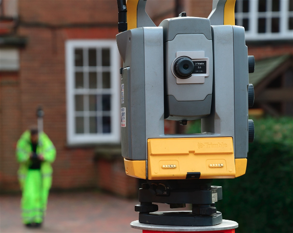
Topographic Surveys
UAS topographic surveys produce highly accurate data across large areas including those which are inaccessible on foot. This data can be combined with ground-truthing from a terrestrial topographic survey.
Outputs include a high-density georeferenced point cloud, Digital Elevation Model (DEM) orthorectified photo, and 3D model.
The combined datasets can be drawn in CAD.

Point Clouds
UAS photogrammetry surveys produce high-density point clouds for buildings and landscapes.
This data can be combined with terrestrial topographic and laser scanning surveys to fill in gaps where ground techniques can’t reach.

Solar Farm Surveys
Thermographic surveys are essential in the maintenance of solar farms.
Thermal imaging can detect heat signatures that may be indicative of defective solar cells. From a small group of panels on residential houses to a large solar farm, a UAS thermographic survey offers the most rapid and cost-effective solution to identifying panel defects and mitigating energy loss.

Roof Inspections
Roof inspections provide an effective and detailed record of the conditions of roofs and wall tops without the costs and risks associated with scaffolding and working at height.
By producing a photographic record, UAS roof inspections can identify damage to masonry, lead work, roof tiles and chimneys as well as areas of water retention and ingress. A follow-up report can be provided to compile the photos and discuss the general condition of the roofs.

Asset Inspections
Equipped with a high-resolution camera, a UAS can capture detailed photos and video of structures or buildings from a unique perspective which may otherwise not be visible from the ground. Repeat visits, as required, allow for monitoring of assets over a specific duration to identify the general conditions of particular features and areas of concern.

Volumetric Analysis
Volumetric surveys conducted by UAS produce highly accurate calculations of stockpiles, spoil heaps and excavations without the need to access them on foot.

Thermographic Surveys
Thermal imaging uses Infrared Thermography (IRT) to detect infrared radiation emitted by an object and translate the reading into heat. The images are processed using thermographic software to identify hot and cold spots which may be indicative of air leaks, water ingress, or faults in photovoltaic cells. Thermal surveys are generally conducted at night to avoid disturbance from reflected solar radiation.

Building Recording (3D Modelling)
UAS photogrammetry is a cost-effective method for surveying places that are otherwise difficult to access, such as roofs and tall façades, without the need for scaffolding or ladders.
As well as providing a highly detailed photographic record, historic buildings can be preserved as a 3D model from which outputs, including orthographic elevations and point cloud data, can be utilised by architects, masons, and engineers.

Landscape Surveys
UAS photogrammetry surveys have the capacity to map 100+ hectares in a single day, providing a highly effective and efficient method for mapping landscapes.
This technique can complement large-scale topographic surveys ahead of new developments, produce a base map for commercial projects, and identify subtle earthworks with archaeological potential.

DEMs
(Digital Elevation Models)
DEMs contain topographic data across the site. These models can be manipulated in GIS software to tease out subtle, microtopographic features, and provide a huge amount of information for interpretive reports.

Multispectral Surveys
Multispectral surveys have the capacity to detect sub-surface features with archaeological potential.
This method uses a camera array equipped with multiple sensors to acquire data invisible to the human eye across the electromagnetic spectrum. When sub-surface features impact the overlying ground, they may be detected following a multispectral survey.

Archaeology Surveys
Our range of UAS geospatial surveys are among the most efficient, non-invasive techniques for identifying and recording archaeology.
UAS surveys can be applied throughout the lifecycle of a project, from landscape surveys to detect features with archaeological potential and help target geophysics, to recording excavated sites for quick, high-resolution mapping.

Internal Photogrammetry
Photogrammetry is a versatile method for creating a visual record of features such as landscapes and buildings, however its application isn’t restricted to the outdoors. Subjects within buildings can also be recorded to produce high resolution orthographic photos and 3D models.

Orthographic Elevations
High-resolution orthographic elevations can be produced following a photogrammetry survey of buildings and structures.
These images provide a detailed, scalable visualization which may assist architects and archaeologists alike.

Stone-by-Stone Illustrations
To further aid architects and archaeologists, detailed stone-by-stone illustrations can be produced from the orthographic elevation.

Line Drawings
Where only basic levels of detail are required, line drawings from the orthographic elevations provide a simple outline of the subject.

Interpretive Reports
GIS analysis provides the backbone of our interpretive reports, using photogrammetry to better understand the topography of a site.
Where multispectral and thermography have been employed, these techniques can be combined to produce a thorough interpretation identify archaeological and environmental features.

Detailed Figures
The above report will present a series of figures including the site orthophoto, the DEM following various analyses, any multispectral images with raster transformations, and thermal images.
These outputs serve as basis for an interpretation, amalgamating all the datasets into a single figure.

Historic Building Reports
Our Historic Building Reports follow a similar format to the above, though instead draws its results from the orthographic elevations and general photography.
From this, phase plans can be produced as part of a thorough historic record.

Water Leak Detection
A multidisciplinary survey consisting of RGB and multispectral photogrammetry along with thermal imaging can identify possible leak locations.
These can be targeted for further inspection using GPR (Ground Penetrating Radar).
Want to learn more?
Please pick up the phone and speak to Simon Batsman on