Search Results
100 results found with an empty search
- Unlocking the Benefits of 3D Laser Scanning Modelling in Surveying and Construction
In recent years, 3D laser scanning modelling has emerged as a game-changer in the construction and surveying industries. This advanced technology offers a wealth of benefits, from increased accuracy and time efficiency to cost savings and enhanced visualisation. In this blog, we'll delve into how 3D laser scanning works, the advantages it brings, and how it is revolutionising project planning, quality control, and renovation efforts. Understanding 3D Laser Scanning Modelling 3D laser scanning modelling is a surveying technique that captures detailed spatial data using laser beams. The scanner emits a laser that bounces off surfaces, measuring the distance between the scanner and various points in the environment. Whether you're conducting a 3D laser scanning survey for a building, land, or a complex topography, this method allows you to create highly detailed representations of spaces for a wide range of applications. How Accurate is 3D Laser Scanning Modelling? One of the primary advantages of 3D laser scanning is its incredible accuracy. The technology offers millimetre-level precision, making it ideal for projects where exact measurements are critical. This accuracy helps reduce the margin for error, ensuring that models reflect the true dimensions and features of the scanned environment. With laser scanning surveying, intricate geometries, angles, and hard-to-reach areas can be captured with unmatched detail, improving project outcomes across various industries. Time Efficiency and Speed Traditional surveying methods can be time-consuming and labour-intensive, but 3D laser scanning services drastically speed up the data collection process. A laser scan survey can cover vast areas or complex sites in a fraction of the time it takes for manual measurements. This speed enables quicker decision-making and real-time updates, which helps keep projects on schedule and reduces the risk of delays. By integrating 3D laser scan surveys, project managers can focus on other essential tasks, confident that accurate data will be collected promptly. Cost Savings in Projects Implementing 3D laser scanning can result in significant cost savings over the lifespan of a project. For one, the technology minimises the need for repeated site visits, as one scan can capture all the necessary data. Additionally, the accuracy of laser scan surveys reduces costly rework caused by errors in measurements or miscommunication between teams. The precision and detail also allow for better planning and resource allocation, ensuring that projects stay within budget and avoid unnecessary expenses. Enhanced Visualisation and Detail The level of detail captured by laser scanning 3D modelling is a major asset, particularly in complex projects. The data collected can be visualised in high-resolution 3D models, allowing stakeholders to explore every aspect of a site or structure. These models can be rotated, zoomed in on, and manipulated to provide a complete understanding of the space. This enhanced visualisation is invaluable for architects, engineers, and project managers when making critical decisions and presenting ideas to clients. What Are the Benefits of Non-Invasive 3D Laser Scanning? Another significant advantage of 3D laser scanning is that it is non-invasive. This means that the scanning process can be conducted without disrupting the site or structure being surveyed. This is particularly important for heritage buildings, sensitive environments, or active construction sites where minimal interference is crucial. Non-invasive 3D laser scanning allows for comprehensive data collection without causing damage or delays, making it an ideal solution for delicate or restricted areas. Where is 3D Laser Scanning Modelling Used? The applications of 3D laser scanning modelling are vast. This technology is widely used in construction, architecture, engineering, and surveying. It plays a key role in laser scanning building surveys, topographic surveys, civil engineering projects, and land development. Beyond these industries, 3D laser scanning is also used in heritage preservation, industrial design, and even in film and animation for creating highly detailed models of real-world environments. Supporting Design and Planning By providing accurate 3D models, 3D laser scanning supports better design and planning processes. Architects and engineers can visualise spaces before construction begins, allowing for informed decisions and more effective collaboration with other teams. The detailed models help identify potential design challenges early, reducing the likelihood of errors during the build phase. Improving Quality Control Quality control is essential in any construction or surveying project, and laser scanning services provide a robust tool for ensuring high standards. By comparing the 3D model against design specifications, discrepancies can be identified early, preventing costly mistakes. Additionally, regular scanning throughout the project timeline ensures that quality is maintained, and any issues can be quickly addressed. Facilitating Renovation and Restoration Renovation and restoration projects often face unique challenges, particularly when dealing with older buildings or incomplete documentation. 3D laser scanning for building surveys provides a reliable and accurate way to capture existing conditions, even in buildings with complex structures or limited accessibility. This precise data ensures that renovation plans are based on current, accurate information, minimising the risk of unforeseen issues and streamlining the restoration process. Integration with BIM and Other Technologies One of the key strengths of 3D laser scanning is its compatibility with Building Information Modelling (BIM) and other advanced technologies. Laser scan to 3D model data can be easily integrated into BIM platforms, creating a digital twin that enhances collaboration, reduces rework, and improves project efficiency. This seamless integration ensures that all stakeholders have access to accurate, up-to-date information, making it easier to coordinate efforts and achieve project goals. What Are the Environmental and Safety Benefits of 3D Laser Scanning? 3D laser scanning offers environmental and safety benefits that traditional methods simply cannot match. Since the technology allows for detailed data collection from a distance, it reduces the need for personnel to access potentially hazardous areas. This increases safety for workers while also minimising environmental disruption. Additionally, by reducing rework and resource wastage, laser scanning services contribute to more sustainable project practices, ensuring a lower carbon footprint and less material waste. Challenges and Considerations While 3D laser scanning offers many advantages, it’s important to be aware of potential challenges. The initial investment in 3D laser scanning survey equipment can be higher than traditional methods, and specialised expertise is often required to operate the technology and interpret the data. However, the long-term savings and benefits in accuracy, speed, and detail make it a worthwhile investment for most projects. Success Stories in 3D Laser Scanning Modelling Many successful projects have demonstrated the value of 3D laser scanning modelling. For example, construction firms have used laser scanning to monitor the progress of large-scale builds, ensuring everything stays on track. In restoration projects, heritage buildings have been accurately documented and preserved, while engineers have relied on 3D laser scanning land surveying to design and construct infrastructure in challenging environments. These success stories highlight the technology's versatility and reliability. Choosing the Right 3D Laser Scanning Service To fully benefit from 3D laser scanning, it’s essential to choose the right service provider. Look for companies with experience in your industry, equipped with the latest laser scanning 3D modelling technology, and a strong reputation for delivering precise, reliable data. The right provider will guide you through the process, ensuring that you get the best results for your project. Experience the Power of 3D Laser Scanning for Your Projects The future of construction and surveying is here, and it’s powered by 3D laser scanning. With its ability to enhance accuracy, speed up timelines, reduce costs, and improve visualisation, this technology is a must-have for any forward-thinking developer or engineer. Don’t miss out on the benefits—consider incorporating 3D laser scanning into your next project. FAQs What are the 5 key benefits of using laser scanning? Laser scanning offers exceptional accuracy, time efficiency, cost savings, improved safety, and enhanced visualisation. What are the benefits of 3D scanning? 3D scanning provides detailed, millimetre-level data that helps reduce human error, speeds up project timelines, and supports better decision-making. What are the pros and cons of 3D laser scanning? The main pros are high accuracy, speed, and reduced labour costs. The cons include the initial investment in equipment and the need for specialised expertise to operate and interpret the data. What are the benefits of 3D LiDAR? 3D LiDAR technology offers precise, non-contact data collection, ideal for mapping large areas, monitoring environments, and enhancing project accuracy. What is 3D laser scanning modelling? 3D laser scanning modelling is a process that captures detailed spatial data using lasers, converting it into accurate 3D models for various applications. How accurate is 3D laser scanning modelling? 3D laser scanning provides millimetre-level precision, ensuring highly accurate models that capture complex geometries and reduce human error. How does 3D laser scanning save time in projects? The technology allows for faster data collection and model creation, streamlining project timelines and enabling real-time updates. How does 3D laser scanning reduce costs in projects? It minimises rework, reduces the need for site visits, improves resource allocation, and offers long-term financial benefits through accurate planning. Where is 3D laser scanning modelling commonly used? It’s widely used in construction, architecture, engineering, heritage preservation, industrial design, and even in film and animation for creating detailed models. Can 3D laser scanning be integrated with other technologies like BIM? Bring Your Projects to Life with Precision 3D Laser Scanning Unlock the full potential of your construction, surveying, or restoration projects with the power of 3D laser scanning modelling. Let us help you take your project to the next level with cutting-edge technology and expert service! To find out more and receive a quote, you can contact us on 0845 456 1104 or you can reach out to our team online here .
- SUMO Air Space - Multispectral Surveys to Identify Solution Features
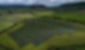
The latest from SUMO GeoSurveys, providing a range of aerial and geospatial surveys using drones, known commercially as UAS (Unmanned Aircraft Systems). The Solution is a Drone Survey Drone Multispectral Surveys have the ability to identify possible solution features on large areas, serving as a first port of call for site investigations. These surveys allow geological anomalies to be targeted by other specialist geophysical techniques such as Ground Penetrating Radar (GPR), Electromagnetic Conductivity (EM), or Resistivity Imaging (ERT); or directly by intrusive investigations. . This fast and informative approach can greatly assist design, identify potential hazards to construction operations, and prevent the development of sink holes. Solution, Dissolution, and Sink Holes A solution or dissolution feature is a cavity in soluble bedrock like limestone, chalk or gypsum, formed in the distant past by natural erosion over long periods of time. These cavities can be infilled by soft sediment (superficial Quarternary deposits), especially in chalk. Erosional processes, such as flowing/leaking water, or mechanical disturbances can cause the sediments to be destabilised and removed, resulting in sink hole formation. Above: Multispectral image from a Solution Feature survey. The Multispectral Method Multispectral surveys involve a drone equipped with a 5-band sensor array which collects images at different wavelengths using reflected light. These bands are green, red, red-edge, near-infrared, and RGB, the latter of which can be processed to extract the blue band. For a survey area covered in vegetation, the reflectance represents the amount of chlorophyll present in the plants; an indicator of the plants’ health. Since plant health can be influenced by sub-surface features, Multispectral Surveys can show where these features are by the appearance of the plants in the processed image. For stripped or bare earth survey areas, the reflectance can represent soil organic carbon, soil moisture, or soil texture/density. Above : Site undergoing geotechnical investigations including a Drone Multispectral Survey to detect solution features Raster Transformations The multispectral orthorectified photo can undergo a series of raster transformations, according to different Vegetation Indexes (VIs). VI formulae combine surface reflectance using two or more wavelengths that are designed to highlight a particular property of vegetation, which may then indicate sub-surface variation. These formulae are applied to multispectral images to produce a variety of indices. We typically carry out 9 transformations including: Normalized Difference Vegetation Index (NDVI) which quantifies the presence of living green vegetation using reflected light in the visible and near-infrared bands; and Red Edge Normalized Difference Vegetation Index (RENDVI) which uses reflectance measurements in the Red Edge (RE) to establish changes in vegetation health. The various transformations provide a detailed account of plant health and soil composition, allowing for greater understanding of sub-surface potential. Above : Various vegetation indexes. Thorough Approach We have the capacity to capture RGB and multispectral data simultaneously, enabling us to conduct an earthwork and sub-surface survey at the same time. With the ability to record upwards of 100 hectares in a single day, we can very quickly and efficiently provide detailed knowledge of an historic landscape. Both datasets will be georeferenced to OS coordinates, generally achieving an error of <3cm and a ground sampling distance of 1 – 3cm / pixel. The RGB survey will produce an orthorectified photo, Digital Elevation Model (DEM), and 3D model of the site, to complement the various transformations from the multispectral survey. Above : Orthorectified photo of a large landscape. The various multispectral and RGB outputs are analysed to produce an interpretation figure, highlighting possible solution features and categorising them into priorities for further investigation, according to the strength of the anomaly. Above : Interpretation figure, highlighting anomalies to be prioritised for further investigation. Want to learn more? Please pick up the phone and speak to Simon Batsman on 07542 60 21 01
- SUMO Air Space - Drones in Archaeology and Heritage
The latest from SUMO GeoSurveys, providing a range of aerial and geospatial surveys using drones, known commercially as UAS (Unmanned Aircraft Systems). To explore our full range of drone surveys, click here . Experts in Archaeology SUMO GeoSurveys is one of the UK’s leading drone providers for archaeological and heritage projects. Our experienced team have you covered from small-scale excavations to large-scale earthwork surveys; building recording to detailed Illustrations; volumetric reports of spoil heaps to GIS analysis and interpretations. Our range of techniques and skills are effective at all stages of historical projects, offering a thorough recording package, carried out efficiently and cost-effectively. With teams from St. Austell to Orkney, we cover every part of the UK. Our high level of appropriate insurance means that we can offer a reliable and proficient service to ensure that your project is in safe hands. Above: Aerial photo from a Building Recording survey. At the Helm SUMO Services’ drone network is overseen by Simon Batsman, Operations Manager (Geospatial). Simon graduated from the University of Winchester with a First Class degree in Archaeology and was awarded the departmental prize for that year’s best dissertation in which he used GIS to illustrate the relationship between coastal erosion and coastal archaeology in Norfolk. His first job after university was that of a GIS technician before joining Oxford Archaeology (OA) as a field excavator, soon becoming an assistant supervisor, then enrolling on OA’s Geomatics placement. Here, he learned various geospatial skills including topographic mapping and photogrammetry. In 2020, Simon joined SUMO Services’ drone department, known then as Aerial-Cam Ltd. He soon achieved his CAA drone certifications (A2 CofC and GVC) and was able to utilise his previous experience of archaeological fieldwork and ground surveying into aerial photogrammetry. Over the proceeding 5 years, he developed as an assistant geospatial surveyor to running the department, embarking on a range of projects including archaeology and heritage, as well as in the wider sector such a commercial building recording, solar farm inspections, topographic surveying, and much more. Above: Simon Batsman, Operations Manager (Geospatial) for SUMO GeoSurveys. SUMO GeoSurveys in Archaeology and Heritage SUMO is well established in the historic landscape sector, with decades of experience in Geophysical and Aerial Surveying. Featuring on the likes of Time Team, Digging For Britain and in countless magazines, SUMO is a staple of archaeological recording in the UK. Our concise methodologies, often combining Geophysical and Aerial Surveys, amount to a thorough account of a site’s history. We are increasingly using RGB and Multispectral Drone Surveys to target areas for Geophysics, or even surveying an entire site with both aerial and ground techniques to paint a full picture of archaeological features.This two-pronged approach can greatly reduce the need for invasive methods, such as trial trenching, both preserving the underlying archaeology as well as saving substantial costs in the long run. Multispectral Drone Surveys can also serve as an alternative to Geophysics when access is limited or prohibited, particularly when the crops are high. Above: Combined UAS RGB and Multispectral, and Geophysical (Magnetometry) interpretations. Digital Drone Deliverables The versatility of drone surveying equates to a range of utilities and outputs which will contribute to your project, be it part of a planning application, historical assessment, restoration project, or research dig. Orthophotos Above : Orthophotos (landscape and earthwork recording). Drone-based photogrammetry can produce high-resolution orthophotos of sites, ranging from small excavations up to expansive landscapes spanning hundreds of hectares. The same approach can be applied to any site, whether it’s rural or urban.Using ground control targets and GPS, the orthophoto will be georeferenced to OS coordinates with an error of <5cm (though generally between 1 and 3cm), therefore scaled and projected accurately for use in GIS. This high level of mapping provides a visual record of a site’s location, condition, and features, and is a much quicker and, therefore, cheaper method than terrestrial surveying. Digital Elevation Models (DEMs) Above : Digital Elevation Model (DEM) for GIS analysis. Digital Elevation Models (DEMs) contain X,Y,Z data across a site and present the gradients according to a colour palette. The DEM can be analysed and manipulated in GIS software to tease out topographic and micro-topographic features which may relate to archaeology. Consequently, the DEM serves as the basis to our interpretive reports. Multispectral Above: Multispectral surveys for sub-surface investigations. Multispectral Surveys have the capacity to detect sub-surface features with archaeological potential. This method uses a camera array equipped with multiple sensors to acquire data invisible to the human eye across the electromagnetic spectrum. When sub-surface features impact the overlying ground, they may be detected following a Multispectral Survey.This technique can be used as an alternative to geophysics when physical access is prohibited or restricted, for example due to crops. Alternatively, it can be employed to support geophysics. RGB photogrammetry is carried out simultaneously, providing both datasets and informing an interpretive report. Excavation Recording Above: Excavation recording (pre-, mid- & post-ex surveying for ongoing progress monitoring). Drone photogrammetry can be conducted throughout the lifetime of an archaeological excavation, providing ongoing records at each stage. This method is far quicker and accurate than manually recording each feature with a GPS or hand-drawn plan.Orthophotos and DEMs are georeferenced to OS coordinates, meaning that these outputs can be dropped into position in GIS for measurements, digitization, and analysis.General site photos and video can further convey the progress of an excavation and serve as marketing material.Multiple visits to a site can be booked in advance at a discounted price. Historic Building Models Above: 3D model of a castle, created using drone photogrammetry. Drone photogrammetry can be employed to create 3D models of buildings and structures, creating a digital record of the subject. The use of a drone means that the whole building can be recorded safely from the ground without the need for manually accessing higher areas. From the model, high-resolution orthographic elevations can be produced and serve as a basis for Line Drawings and Stone-by-Stone Illustrations. These outputs can be used by architects, historians and masons as part of a restoration project, Historic Building Recording, or shared for marketing and publicity. Where greater accuracy is required, the photogrammetry can be combined with a terrestrial Laser Scan Survey for improved scaling and projections. Above left: Orthographic elevation for historic building recording. Above right: Line drawing. Above: High detail stone-by-stone illustration. GIS Analysis and Interpretive Reports Above: Interpretive report. Drone surveys amount to only half of what SUMO’s geospatial department is capable of. The real value of our work comes down to our reporting, including our highly detailed interpretive reports of Landscape/Earthwork Surveys. These reports include scaled figures following GIS analyses of the DEM and multispectral vegetation indexes (if applicable), an illustrated interpretation figure to highlight topographic and multispectral anomalies, and a concise but detailed discussion. Other sources, such as available LiDAR or HER accounts, may be included, and recommendations for future work may also be added. Historic Building Recording Above: Phase Plan for level 2 Building Recording. Similarly, we can produce Level 1 and Level 2 Historic Building Recording reports. We favour using photogrammetry to model the building, and produce orthophotos from which measurements can be obtained and a phase plan drawn up. Alternatively, we can capture the images and carry out photogrammetry to feed into your own reports, if required. Volumetric Calculations Above: Volumetric Report. Volumetric surveys carried out by drones are a safe, cost-effective and efficient way of measuring spoil heaps and excavations, to aid the planning and management of a project. This information can be extracted following a photogrammetry survey of a site of spoil heap. Setting Surveys By their nature, drones offer an unparalleled perspective of historical buildings, structures and landscapes, and are therefore the ultimate tool for Setting Surveys. General photos and video, photogrammetry (where applicable) and panoramic spheres, can perfectly showcase an historic asset within its wider context. Want to learn more? Please pick up the phone and speak to Simon Batsman on 07542 60 21 01
- SUMO Air Space Solar Farm Surveys (Thermography)
The latest from SUMO GeoSurveys, providing a range of aerial and geospatial surveys using drones, known commercially as UAS (Unmanned Aircraft Systems). Solar Express! Drone thermography is an unrivalled method for inspecting solar farm arrays to identify faults in the photovoltaic cells, and target panels for repairs. This technique forms an integral part of a wider maintenance programme, ensuring that solar farms across the country are able to function at their optimal capacity. Video 1 : Drone Thermographic Solar Farm Survey in action Thermographic Methodology A drone is flown across each solar array at low-altitude, recording sequential thermal video and standard RGB video. Each frame can be analysed by an independent thermographer to identify hot and cold spots in the cells which indicate faults in the panels, likely impacting the efficiency of the solar farm. Various colour palettes can be applied to the thermographic video, and the temperature parameters can be adjusted to help isolate anomalies in the solar panels. Above: Solar farm awaiting a drone inspection In addition to the thermographic video, standard RGB video and site photos are captured. This provides essential information regarding the conditions of the panels and site on the day of the survey. The RGB video supports the thermographic data by offering a visual of the surface of the panels which, from the thermal data only, may easily be misconstrued. Bird droppings, for example, may appear as anomalous features in the thermographic dataset and, while impacting the efficiency of the cells and posing a long-term risk of damage, may require a simple cleanup rather than technical repairs to the hardware. The combined thermographic and RGB datasets will contribute to a report, detailing which cells require maintenance. Above : Site photo of a largescale solar farm The survey is carried out between April and October when solar irradiance is at a suitably high level. A solar irradiance monitor is used prior to and following each flight, and the reading is documented in the flight record. Above : A frame captured from the sequential thermal video with several hotspots identified. Drone Capabilities With the capacity to survey largescale solar farms in considerably short time, a drone thermographic survey is a highly efficient and cost-effective approach within that solar farm’s maintenance programme. Above : Small solar farm following a UAS thermographic survey. Want to learn more? Please pick up the phone and speak to Simon Batsman on 07542 602101
- How SUMO can Benefit the Rail Industry
The rail industry is vital to the UK's infrastructure, uniting communities, fuelling economic growth, and alleviating road congestion. Maintaining and improving rail networks demands careful planning, precise engineering, and innovative solutions. SUMO stands ready to empower the rail industry to overcome these challenges by offering a comprehensive range of surveying services that enhance safety, efficiency, and project outcomes. Delivering Precision with Advanced Surveying Technology At SUMO, our advanced surveying technology enables us to transform visions into reality. Whether constructing new rail lines, maintaining vital infrastructure, or revitalising and expanding stations, we harness innovative techniques to achieve unparalleled accuracy. Topographical Surveys We provide detailed topographical surveys that form the foundation for successful rail projects. Our surveys deliver precise data on land contours, structures, and surrounding features, enabling effective design and planning. Measured Building Surveys Upgrading or refurbishing structures, bridges, tunnels and stations requires precise mapping. Our measured building surveys provide a detailed vision of layouts and dimensions, ensuring smooth project execution. Enhancing Safety Through Non-Invasive Methods The rail industry operates in high-risk environments, where safety is paramount. SUMO offers a range of non-invasive surveying methods that minimise disruption while maximising safety. Utility Detection Rail projects often overlap with underground utilities. Our state-of-the-art utility detection services identify the location and depth of buried services, reducing the risk of costly and dangerous utility strikes. Ground Penetrating Radar (GPR) GPR surveys enable us to find potential hazards without the need for invasive excavation. This is especially valuable for trackbed investigations or station developments. Unmanned Aircraft Systems (Drones) Drones significantly enhance rail surveys by enabling safe, efficient, and accurate data collection in challenging environments. They can access hard-to-reach areas like steep embankments, bridges, and tunnels without disrupting rail operations. Equipped with high-resolution cameras, drones provide detailed imagery and 3D models for quick assessments. Their ability to cover large areas rapidly reduces both time and costs compared to traditional methods. Additionally, drones minimise risks to personnel and ensure safety on live tracks, eliminating any downtime associated with track possession. Reducing Downtime with Efficient Workflows We understand that minimising disruption to rail services is a top priority. SUMO’s highly skilled PTS-trained teams and efficient workflows ensure swift project delivery, allowing rail projects to progress with minimal impact on daily operations and expensive downtime on busy rail lines. Committed to Sustainability Sustainability is a key consideration for the rail industry, and our services align with this vision. By employing non-invasive techniques, thus eliminating heavy fume-emitting excavation machinery, SUMO reduces the carbon footprint of any project to deliver accurate data to optimise construction. SUMO is committed to supporting environmentally friendly rail projects. Why Choose SUMO? At SUMO, we pride ourselves on being a trusted partner to the rail industry. Our combination of technical expertise, innovative solutions, and a commitment to client success ensures we consistently deliver exceptional results. Whether you are embarking on a major infrastructure project or need support for ongoing maintenance, we have the skills and technology to make it a success. Receive a quote today. You can contact us on 0845 456 1104 or you can reach out to our team online here .
- SUMO Geophysics: where we came from and where we are going...
As the UK’s first commercially operating geophysicists in archaeology, we thought it would be interesting to look back at SUMO Geophysics’ long-standing history, what sets us apart from other groups, where we came from and where we are headed. So, let’s start at the beginning… SUMO Geophysics Ltd has grown to be the largest and most experienced group of UK geophysicists working in the field of archaeology. The business emerged from the joining of the two leading proponents of near surface geophysics: (founded by Dr John Gater) and Stratascan Ltd (founded by Peter Barker). Dr John Gater (who carried out his first surveys back in 1974) founded GSB Prospection Ltd in 1986 and at the time, it was the first commercially operating geophysics organisation and the first commercial geophysics organisation to be registered with the Chartered Institute for Archaeology (CIfA). Peter Barker subsequently founded Stratascan Ltd in 1990 and it rapidly grew to become the largest commercial geophysics supplier in the country. Fast forward to 2019, John is now Director of Archaeology for SUMO Geophysics, with Peter Barker working alongside him as a Consultant to SUMO Geophysics. Above : Peter Barker with his early geophysics equipment, the SIR 3 Radar System. We are extremely fortunate to have Peter and John at SUMO, as their expertise is widely recognised throughout the industry. They have received numerous awards and co-authored many geophysics publications over the years: - Dr John Gater was awarded an honorary Doctor of Science by the University of Bradford for his "distinguished contributions to the field of Archaeological Geophysics". He has also achieved the following: - Co-authored The use of Geophysical Techniques in Archaeological Evaluations ' IFA Paper No. 6 (2006). John was a founding member of the now Chartered Institute for Archaeologists (CIfA) and became a full Member (47) in 1993. Holds Fellow membership with the Society of Antiquarians (FSA). He co-authored ‘ Revealing the buried past: Geophysics for Archaeologists ‘ (2003). Tempus Publishing Limited. He maintains an Honorary Research Fellowship at Bradford University and has been an Assistant Editor of the Journal of Archaeological Prospection for over 25 years. For 20 years, John was the ‘public face of geophysics’ on Channel 4’s award-winning archaeology programme, Time Team . Peter Barker was the winner of The Survey Association (TSA) President’s Award for outstanding contribution to the TSA and the survey industry during 2010. He has also achieved the following: - For many years, Peter was a member of the CIfA Council, TSA Council and a committee member on the EuroGPR Association. He was author of the TSA Essential Guide to Utility Surveys. He was a member of the drafting panel for British Standard PAS 128. He was Chair of the TSA Technical Committee for roughly 5 years and of the CIfA Special Interest Group in Geophysics (GeoSIG). He led the production of the first edition of the CIfA Standard and Guidance for Archaeological Geophysical Surveys . He was a member of the CIfA inspection panel of Registered Organisations and was Secretary to the Impulse Radar Users Association for a number of years. Above : Dr John Gater, Director of Archaeology at SUMO Geophysics. What notable projects have SUMO Geophysics worked on? More than 6000 surveys have been carried out over the past 33 years. These have been largely developer-led projects, but SUMO Geophysics has been responsible for carrying out numerous, high-profile research projects, all of which have been published. These projects include: - Stonehenge Environs & A303, a decade of geophysics surveys during the late 1980s and 1990s. Antonine Wall for Historic Scotland / Professor David Breeze in 2008. Richard III for Leicester University. Glastonbury Abbey for Professor Rebecca Gilchrist in 2009. The Carthusian Abbeys alongside RCHME and Professor Mick Aston during the 1990s. Orkney Neolithic World Heritage Site – Historic Scotland Orkney College 1990s. Castles in Wales for CADW, Rick Turner and Sian Rees. Rochester Cathedral. Tower of London for HRP. Kew Gardens. We have also completed surveys at several Royal Palaces such as Hampton Court, Buckingham Palace and Windsor Castle for HRP. Old Bulawayo in Zimbabwe. Butrint in Albania. Considering its history, what sets SUMO Geophysics apart from our competitors? In our mind the single biggest advantage we have, has always been the people that we employ within SUMO. We have some fantastic individuals who are well established within their fields. Our staff all buy into the ethos of going the extra mile to get the job done well. Staff are usually qualified to degree or post-graduate level and many are affiliated to CIfA, with qualifications covering both geophysics and archaeology. With more than 30 staff at SUMO Geophysics, we have unrivalled expertise in this specialist field and consistently aim to attract the top talent within the field to maintain our current reputation and quality of work. SUMO Geophysics has maintained a position at the forefront of geophysical advancements, even developing some of the innovative methods of surveying that have been widely adopted throughout the industry. Utilising our industry leading position has allowed us to employ the newest technology to solve a range of archaeological problems. In particular, our personnel have extensive experience of working with multi-antenna Ground Penetrating Radar (GPR) systems. Where is the future of SUMO Geophysics headed? We are extremely lucky to have Adam Stanford (founder and Director of Aerial-Cam) on board. He is widely recognised as one of the most experienced and renowned archaeological photographers working in the UK (and abroad on World Heritage sites). He works regularly for Heritage England and the National Trust, photographing and recording both buildings and landscapes. He holds many industry recognised licences and Accreditation’s such as: Remote Pilot Qualification + CAA PfCO (formerly PFAW). Fellow of the Society of Antiquaries. Member — Chartered Institute for Archaeologists. Life Member — Council for British Archaeology. Honorary Research Fellow — School of Archaeology, Cardiff University. Member — Association of Remotely Piloted Aircraft and Systems - UK. Member — Drone Safe Register. Going forward, exciting developments are likely to involve combining the results from differing survey techniques and presenting the data in a multi-layered format. Combining geophysical techniques with aerial photogrammetric data will also allow us to review the results in their true spatial environment. So, watch this space!
- SUMO Air Space - Interior Photography and Photogrammetry
The latest from SUMO GeoSurveys, providing a range of aerial and geospatial surveys using drones, known commercially as UAS (Unmanned Aircraft Systems). Photogrammetry: the inside scoop! UAS are a versatile tool for creating a visual record of features such as landscapes and buildings, however their application isn’t restricted to the outdoors. Subjects within buildings can also be recorded to produce high resolution orthographic photos and 3D models, as well as capturing general photos and video, no matter the weather! Above : Example orthographic elevation of an internal wall. Technology SUMO GeoSurveys use a selection of cameras to safely and effectively conduct interior photogrammetry surveys. These include a mini UAS with propeller guards, a DSLR mounted on a telescopic mast or held manually, and a gimble-mounted handheld camera. Photos are captured in a methodical grid with an overlap of >60%, enabling the images to be stitched together in photogrammetric software back in the office. All images are captured with the same quality ensuring a high-resolution output. Above : Example orthographic photos of two indoor murals . General photos and video can be captured to inform stock listings and asset inspections, while orthographic photos can be scaled in CAD to support architectural planning and design. Furthermore, our in-house illustrators can produce detailed stone-by-stone or line drawings, if required. Above : Photo inside a warehouse captured with a UAS. 3D Models Photogrammetry can also be used to generate 3D models, from vast indoor spaces (such as factory floors, warehouses and distribution centres) for design, planning, asset recording and general viewing, including simulated walk-throughs. These can be supplied via a link to an online viewing platform or as an independent file in various formats, thereby enabling remote parties to access and visualise the subject without physically visiting it. Point cloud data can be combined with terrestrial MBS to fill in hard-to-reach areas where a laser scanner can’t reach. Above : Snapshot of an interior 3D model of a historic home. Interior UAS photography and photogrammetry is a flexible, cost-effective, and high quality method of recording the internal structures and features of your assets, which don’t rely on good weather/flying conditions, and can be programmed to meet your needs. Want to learn more? Please pick up the phone and speak to Simon Batsman on 07542 602101
- The Solar Series... Soil Thermal Resistivity
The sixth topic in our solar series explores how to prevent premature failures to newly installed underground powers cables. Prior to the design and installation of underground electrical cables on new solar schemes, it is crucial that you understand the thermal properties of the in-situ soil or made ground . It is important to ensure that the heat produced by current flowing through an underground power cable is properly dissipated to avoid premature failures. Often estimations are made, but where conditions are uncertain or variable along a cable route, it is essential that a proper quantitative assessment is made of the ground. The Method: Soil Resistivity Testing Soil thermal resistivity testing measures the capacity of the ground to conduct or dissipate heat. The thermal resistivity of the soil will determine whether a buried power cable remains stable or overheats. A build-up of heat around the cable can reduce transmission efficiency, or in the worst case cause it to melt. The testing procedure involves taking measurements along the cable routes at different locations using a needle probe, which is inserted in a pit or an open trench at the proposed cable depth. Above : A cable route showing 5 locations where the soil thermal properties require to be measured. Above :In-situ thermal resistivity testing with a needle probe. Thermal resistivity readings can then be recorded and presented in a tabulated format to be used for calculations by the installation engineers ahead of the solar panel installation. Above : Example results of thermal resistivity testing at 3 locations. Using this data, potential problems can be identified and remedial measures taken, including changing the capacity and insulation of the cables, or installing corrective thermal backfills in the cable trench. Don’t forget that this is just one of eight surveys that SUMO can supply throughout our solar scheme, from Design, to Construction, and even Monitoring of your Solar panels once installed.
- SUMO Air Space - Building Surveys
The latest from SUMO GeoSurveys, providing a range of aerial and geospatial surveys using drones, known commercially as UAS (Unmanned Aircraft Systems). Building a record! Drone photogrammetry is a highly effective method of Building Recording to inform the condition of a building or structure, and aid restoration work throughout a project. In particular, the production of 2D orthographic images — which provide a detailed visual representation of the roofs and elevations — are an invaluable tool for building management. Above : Example 3D model. 3D Modelling Our in-house geospatial specialists use photogrammetry to model buildings and structures, georeferenced to OS coordinates. The outputs include a 3D model and point cloud data, which can be combined with laser scanning to fill in high-level, out-of-reach places as part of a Measured Building Survey. These can be provided in a format compatible with Revit. Above : Example point cloud. Orthographic Elevations From the digital 3D model, we can generate orthorectified photos of the roofs and elevations. These are high-resolution, scaled and flattened photos which enable those working on the building, such as architects, to assess the condition of each elevation and pin-point areas of interest. Above: Orthorectified elevation of a building undergoing renovations. Stone-by-Stone Illustration When extra detail is required in order to identify particular elements of a building, our in-house team can produce stone-by-stone illustrations. These illustrations can further inform architects and masons on the condition of a building. Above : Stone-by-stone illustration of a an internal elevation of a church. Line Drawings Where only basic levels of detail are required, line drawings from the orthographic elevations provide a simple outline of the subject. Above : Line drawing to show basic architectural detail across the elevation of a castle. Want to learn more? Please pick up the phone and speak to Simon Batsman on 07807 880516
- The Solar Series... Electrical Earthing
The fifth topic in our solar series explores how to avoid damage to solar panels from electrical surges and lightning strikes. Earthing is paramount to the design of new solar farms and associated electrical grid infrastructure, both in order to keep people safe by preventing electric shocks and in avoiding damage from overloading caused by excess currents running through the circuit. Such damage can reduce the efficiency of the solar panels, and even cause them to fail completely, leading to costly repairs or replacements and impacting operational efficiency. Through full understanding the site’s electrical property, an appropriate earthing system can be designed which may include earthing plates, earthing rods, or earthing pits. The Method: Soil Resistivity Testing The electrical properties of a site are measured through soil resistivity testing, which measures the capacity of the ground to pass an electrical current. The procedure involves putting four electrodes into the ground in a fixed configuration array. A low frequency electrical current is applied across the outer electrodes and the voltage is measured between the inner electrodes. Above : Soil resistivity testing in progress on a new solar farm development. A series of depth readings are acquired using different electrode spacings, allowing the apparent resistivity of the ground to be recorded at regular depths to 50m or more at any given point. The resultant data is presented in tabulated form (below) as well as in graphs, listing the electrode spacing, nominal testing depth; electrical resistance for each electrode spacing (R1, R2); average resistance (Rav) and apparent resistivity for each position. As a general rule, lower resistivities make the design and installation of an earthing system simpler. Above : Tabulated soil resistivity testing results at standard electrode spacings . Don’t forget that this is just one of eight surveys that SUMO can supply throughout our solar scheme, from Design, to Construction, and even Monitoring of your Solar panels once installed.
- SUMO Air Space - Drone Surveys for Schools
The latest from SUMO GeoSurveys, providing a range of aerial and geospatial surveys using drones, known commercially as UAS (Unmanned Aircraft Systems). School’s out for the summer! Drone surveys provide a fast, cost-effective and highly accurate means of inspecting roofs, buildings and land to inform maintenance programmes. Using a variety of survey methods and deliverables, drones can serve a range of assessments. With school holidays approaching, there is no better time than now to book in your drone survey. Suite of drone surveys SUMO GeoSurveys has a fleet of different drones and sensors, facilitating a range of specialist methodologies. From high-resolution cameras for capturing detailed photos, to thermal cameras for identifying possible heat loss, our CRB approved surveyors are equipped to help you with your routine maintenance throughout the year. Roof Surveys Drones offer a unique perspective of rooftops without the need to physically access them. Our cameras capture high-resolution photos and video to help assess the condition of the roofs and features, such as gullies, chimneys and tiles. We can also produce condition reports, drawing upon our findings from the survey. Above : Close-up photo of a roof. Building Surveys Drone photogrammetry surveys can produce point cloud data and 3D models of buildings by stitching together a series of photos. From the images captured on site, we can generate orthorectified photos of the roofs and elevations. These are high-resolution, scaled and flattened photos which enable those working on the building, such as architects, to assess the condition of each elevation and pin-point areas of interest. In addition, photogrammetry can be combined with laser scanning to fill in high-level, out-of-reach places as part of a Measured Building Survey. Above: Orthorectified elevation of a school building. Thermal Surveys Specialist thermal cameras can identify hot and cold spots on the roof and faces of a building. In doing so, a thermal survey can indicate areas of poor insulation, air and water leaks, and, if present, faulty panels in solar arrays. Above : radiometric photo of a building, highlighting hot and cold spots across the roofs. Landscape Surveys Drones are the ultimate mapping tool for surveying landscapes, including school grounds. Where land is being acquired or sold, a photogrammetry survey can inform the size and levels of a site, as well as notable features contained within. Outputs include an orthophoto, georeferenced to OS coordinates; a Digital Elevation Model (DEM) containing x,y,z data of the site; and a 3D model. This data can be combined with a traditional topographic survey for improved referencing. Above : orthorectified photo of a school and grounds. General Photography and Video With the ability to capture photos and video from a unique perspective, drone surveys can showcase your school in a new light. As part of any of the above surveys, we always aim to capture a few extra shots for use in your school prospectus, website, newsletters, or social media. Alternatively, if none of the above surveys are required, we can carry out a dedicated marketing survey specifically to capture photos and video. Above : general photograph of a school. Internal Photography and Photogrammetry Using a combination of cameras attached to telescopic masts as well as drones, we can capture photos of high-level areas and carry out photogrammetry surveys indoors to record elevations. This may be of particular help when considering a maintenance programme for high-ceilinged rooms such as school halls and gymnasiums. Above : orthographic photo of an internal elevation. Want to learn more? Please pick up the phone and speak to Simon Batsman on 07807 880516
- SUMO Air Space - Your Questions Answered
The latest from SUMO GeoSurveys, providing a range of aerial and geospatial surveys using drones, known commercially as UAS (Unmanned Aircraft Systems). Ask the Audience! It is important to us that you are as informed as possible when commissioning a UAS survey to make sure you know exactly what you can get out of it. You can find the answers to some frequently asked questions below… Q: What is multispectral and how does it work? In brief, multispectral uses a sensor array which collects images at different wavelengths. These images can be processed to identify the health of plants on the surface. Since plant health can be influenced by sub-surface features, multispectral surveys can show where these features are by the appearance of the plants in the processed image. Therefore, archaeology which doesn’t leave a topographic footprint may still be revealed by UAS multispectral mapping. Q: What level of accuracy can you achieve with your georeferencing, particularly over large landscapes? We typically aim for a georeferencing error of <3 cm. On projects which require even tighter accuracy, we can combine our data with a traditional topographic or laser scanning survey. Q: What solution can you offer for obtaining ground levels beneath tree canopies where photogrammetry cannot reach? We frequently collaborate with SUMO’s traditional topographic department. Where tree canopies obscure the surface, a terrestrial topographic survey can be used to fill in the gaps. Q: Is photogrammetry better than LiDAR? We consider each survey on a case-by-case basis to ensure the best methodology is followed to suit the needs of the job. LiDAR is only preferred over photogrammetry when the survey requires the construction of a Digital Terrain Model (DTM) beneath dense vegetation, in particular woodland. For open sites, such as pastures or urban landscapes, the improved resolution from photogrammetry over LiDAR makes it the preferred choice. Q: At what hectarage does UAS-based LiDAR become more cost effective than manned LiDAR? Manned aircraft are significantly more expensive to commission than UAS. In addition, the ground resolution from a UAS at a maximum of 400ft is much better than that of a plane at a 1000ft. Since UAS surveys can cover over a hundred hectares in a day, manned LiDAR is best suited for surveying extensive woodland where ground control is virtually impossible, and resolution is less of a priority. Q: What are the optimum conditions for a UAS survey? In order to operate safely, it is important that we carefully consider the weather for every job we carry out. Generally, we aim for days which are dry with low winds and proceed only if it’s practicable to do so. Very often, we only find out what the weather will really be like when we arrive on site. Each of our survey methods have further nuances to encourage the best results. RGB photogrammetry works best with little shadow cast over or across the subject; multispectral photogrammetry is most effective within a two hour window either side of midday; thermal building surveys are best carried out at night when there is no solar radiation interference, whereas thermal solar farm inspections require high levels of solar irradiance during the day to be successful. Q: How quickly can you go from instruction to delivery of results? Since UAS surveys are dependent on the ever-changing weather forecast, we are very used to attending site with little notice. We always aim to meet specific dates as provided by the client and make contingencies for the weather when necessary. Initial outputs (e.g orthophoto, Digital Elevation Models, and 3D model) can be provided within 1 – 2 days of the survey, and we aim to deliver the interpretive report within 2 – 4 weeks. Q: Can you operate in restricted airspace? In short, yes, we can operate in most restricted airspace. Prior to supplying a quote, we check to see what airspace your site falls in as this may have a bearing on when we can carry out the survey. It is a legal requirement, governed by the CAA (Civil Aviation Authority) to ensure that we seek permission to fly in restricted airspace, such as FRZs (Flight Restriction Zones) for airfields, prisons, and military bases. There are few instances where UAS operations are not permissible, however we are aware of these locations and can make alternative arrangements if required. Q: Can you carry out earthwork surveys for planning conditions? Absolutely, a photogrammetry survey is the ultimate tool for identifying topographic and micro-topographic features across a site. The outputs include an orthophoto and DEM (Digital Elevation Model), the latter of which can be manipulated in GIS software to analyse the site, and an interpretive report can be drawn up to show the findings. Q: How familiar with UAS surveys are county archaeologists? Our services are being increasingly requested by county archaeologists and, as with all our customers, we are always happy to educate them about the benefits of our techniques and outputs. Q: Can photogrammetry be used in Historic Building Recording instead of traditional photos and annotation? We greatly recommend using photogrammetry in conjunction with traditional photos for Historic Building Recording to produce thorough reports. External photogrammetry is used to generate scalable orthographic elevations which can aid the production of phase plans, whereas traditional photos are favoured internally. In addition, the photogrammetry survey collates an archive consisting of hundreds of photos, as well as the building being preserved as a 3D model. Q: Can UAS be used inside buildings, such as churches? Yes, UAS can be operated inside buildings. We have conducted photogrammetry and general video and photos from within buildings including churches. Q: What outputs can you provide from a building survey? Photogrammetry surveys can produce a range of deliverables, depending on the needs of the client. Standard outputs include scaled orthorectified elevations and roof plan, and a link to a low-resolution 3D model for online viewing. Further outputs include a point cloud, high-resolution 3D model files, all survey photographs, general video, and panoramic spheres. In addition, we can combine our outputs with laser scan data as part of a detailed Measured Building Survey. Q: Is there any archaeology which photogrammetry doesn’t work on? It’s very unlikely that photogrammetry would struggle to work on archaeology since the general materials and surfaces we tend to find in historic settings – such as masonry, earthworks, landscapes, excavations, and even artefacts – are ideal for photogrammetric modelling. If you have any questions please send them through to geosurveys@sumoservices.com Want to learn more? Please pick up the phone and speak to Simon Batsman on 07807 880516