

What Can Go Wrong If You Skip a Topographic Survey?
- May 18
- 8 min read
Think You Can Save Money by Skipping a Site Survey? Think Again.
Every successful development project starts with a clear understanding of the land it sits on. From elevation changes and existing features to underground utilities and boundary lines, the information captured in a topographic survey forms the foundation of every design, planning, and construction decision that follows. Yet some property developers, architects, and landowners still consider skipping this essential step in a bid to save time or reduce upfront costs.
At SUMO Services, we have seen first-hand what happens when projects proceed without a proper topographical survey. The consequences are rarely minor. They range from planning refusals and boundary disputes to costly redesigns, dangerous site conditions, and significant project delays. In this article, we explore the real risks of neglecting a topographic land survey and explain why investing in accurate survey data from the outset is one of the smartest decisions you can make.
Why a Topographic Survey Is a Critical Pre-Construction Step
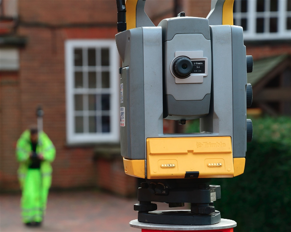
A topographic survey provides a detailed, accurate representation of a site's physical features, contours, and elevations. It captures both natural and man-made elements, including trees, buildings, roads, pathways, slopes, and drainage features. This data gives architects, engineers, and planners the precise information they need to design schemes that work with the land rather than against it.
Without this level of detail, professionals are essentially working from assumptions. Ordnance Survey maps and title plans, while useful for general reference, do not provide the granular, site-specific data required for robust design and construction planning. A pre-construction survey removes the guesswork and gives your project team a reliable baseline to work from. As we say at SUMO, it is all about delivering "no more guesswork above or below ground."
Boundary Disputes and Encroachment Risks Without a Land Survey
One of the most common and disruptive problems that arises from skipping a topographic survey is a boundary dispute. Without a measured land survey that precisely maps the boundaries of your site, there is a real risk that your proposed development could encroach on neighbouring land, or that existing encroachments go unnoticed until it is too late.
Boundary disputes can be extremely costly to resolve and often lead to legal proceedings. The Royal Institution of Chartered Surveyors (RICS) provides guidance on how topographic surveys can help establish property boundaries and resolve disputes before they escalate. For commercial landowners and property developers, getting boundary lines right from the start is not optional. It is essential.
A thorough site survey carried out before any design work begins will clearly define the extent of your site, flag any encroachments, and provide the accurate positional data your legal and design teams need to proceed with confidence.
Planning Permission Problems: Why a Planning Survey Matters
Submitting a planning application without a topographical survey is a gamble. Local planning authorities expect submissions to be based on accurate, up-to-date site data. If your drawings do not reflect the true conditions on the ground, including levels, existing structures, trees, and access points, your application could be refused or delayed.
A planning survey gives your architect or planning consultant the detailed site information they need to produce compliant and realistic proposals. It shows how the proposed development relates to its surroundings, how surface water will drain, and whether there are any level changes that need to be addressed in the design. The UK Government's planning guidance outlines various requirements around land use and development that must be considered, and accurate topographic data is often at the heart of meeting these requirements.
We regularly work with planning consultants across the UK who rely on our survey data to support their applications. Getting this right at the outset avoids the frustration and cost of resubmissions and project hold-ups.
Hidden Site Obstacles and Underground Utility Risks
What lies beneath the surface of a site can be just as important as what is visible above it. Underground utilities, old foundations, buried tanks, drainage runs, and other subsurface features can all cause serious problems if they are not identified before construction begins.
Skipping a site investigation survey or utility survey means these hidden obstacles may only come to light once groundworks are underway. Striking an uncharted gas main, water pipe, or electrical cable is not just an expensive mistake. It is a potentially dangerous one. SUMO provides comprehensive utility detection surveys that work alongside our topographic surveys to give you full visibility of what is above and below the ground.
We have dealt with projects across the UK where buried features, from old fuel tanks to disused mineshafts, have been discovered mid-construction because no proper survey was carried out beforehand. Our buried tank detection case study is just one example of how early survey work can uncover risks that would otherwise cause major disruption.
Safety Hazards on Site When Terrain Data Is Missing
Construction sites are inherently hazardous environments, and the Health and Safety Executive (HSE) outlines numerous safety risks associated with construction work. When a project proceeds without accurate terrain data, those risks multiply. Steep slopes, unstable ground, water features, and unexpected level changes can all create dangerous working conditions if they have not been properly identified and planned for.
A topographic land survey captures elevation variations, ground conditions, and natural features that directly influence how a site should be accessed, where plant and machinery can safely operate, and how earthworks should be designed. Without this information, construction teams are working in the dark, increasing the likelihood of accidents, injuries, and costly shutdowns.
For any construction professional or engineer, ensuring that the site has been thoroughly surveyed is not just good practice. It is a fundamental part of managing health and safety obligations on site.
Costly Delays, Redesigns, and Budget Overruns
Perhaps the most persuasive argument for commissioning a topographic survey is the sheer financial impact of not having one. When accurate site data is missing, problems tend to emerge at the worst possible time, typically once construction has already started.
Discovering unexpected ground levels, unmapped utilities, or boundary issues during the build phase leads to costly redesigns, programme delays, and additional expense that could have been avoided entirely. Foundations may need to be redesigned, drainage strategies reworked, or access routes changed. Each of these changes costs time and money, and the cumulative effect can be devastating for project budgets and timelines.
By contrast, a pre-construction survey carried out by an experienced provider gives your project team the data they need to make informed decisions from day one. The cost of a topographical survey is a fraction of the expense associated with resolving problems that proper surveying would have identified upfront.
How Drone Topographic Surveys and Laser Scanning Add Value
Modern surveying technology has made it faster and more efficient than ever to capture detailed site data. At SUMO, we use a combination of traditional total station surveys, GPS equipment, drone topographic surveys, and laser scanning and 3D surveying to deliver the most accurate and comprehensive results.
Drone surveys are particularly valuable for large or hard-to-access sites, capturing high-resolution aerial data that can be processed into detailed topographic models. Laser scanning provides incredibly precise 3D data that is ideal for complex sites or projects requiring integration with BIM workflows.
By combining multiple survey methodologies, we ensure that every project benefits from the most appropriate and cost-effective approach. You can explore our full range of surveying services and see how we have applied them on real projects through our case studies.

The Smart Investment: Why Proper Surveying Pays for Itself
A topographic survey is not a cost to be minimised. It is an investment that protects your project from the very risks outlined above. Accurate survey data enables better design, smoother planning applications, safer construction, and more reliable cost estimates. It reduces the likelihood of disputes, delays, and nasty surprises.
At SUMO, we deliver survey data that is clear and accurate, supported by top-quality full-colour survey drawings and detailed post-survey explanations of results. Our team is strategically located throughout the UK, providing nationwide coverage and fast turnaround from first enquiry to quotation. We also offer post-survey support, so if you have questions about your data after delivery, we are here to help.
One of our long-standing clients put it perfectly: "SUMO has always provided us with a quality, competitive and trustworthy service. Their involvement in the early stages of a project helps us to mitigate potential issues and risks."
Do Not Let Poor Planning Derail Your Next Project
Skipping a topographic survey might seem like a shortcut, but as we have explored throughout this article, it is a decision that almost always costs more in the long run. From boundary disputes and planning refusals to safety hazards and construction delays, the risks of proceeding without accurate site data are simply too significant to ignore.
Whether you are planning a commercial land survey for a new development, need a site survey to support a planning application, or require a full site investigation survey before breaking ground, investing in professional surveying services from the start will save you time, money, and stress.
At SUMO Services, we provide a fully comprehensive suite of survey services from one survey company, giving you full visibility above and below the ground. With offices across the UK, from Bradford and Darlington to Havant and St. Austell, we are well placed to support your project wherever it is located.
FAQs
What is included in a topographic survey?
A topographic survey captures and maps both natural and man-made features of a site, including elevation data, contours, buildings, trees, roads, boundary features, drainage, and access points. The resulting survey drawings provide a detailed and accurate representation of the site's physical characteristics.
Can I use Ordnance Survey maps instead of a topographic survey?
Ordnance Survey maps provide a general overview but lack the precision and detail required for design, planning, and construction purposes. A topographic land survey provides site-specific data at a much higher level of accuracy, which is essential for making reliable project decisions.
Do I need a topographic survey for planning permission?
While not always a formal requirement, a topographical survey is strongly recommended when submitting planning applications. It ensures your drawings accurately reflect site conditions, which helps avoid refusals, delays, and the need for costly resubmissions.
How does a utility survey complement a topographic survey?
A utility survey identifies underground services such as gas, water, electricity, and telecommunications infrastructure. When combined with a topographic survey, it provides a complete picture of what exists above and below ground, helping to avoid accidental strikes and inform safe design.
How long does a topographic survey take?
The duration depends on the size and complexity of the site. A small residential plot might take a single day, while larger commercial sites may require several days of fieldwork. At SUMO, we pride ourselves on speed from first enquiry to quotation and efficient delivery of survey data.
Is a topographic survey worth the cost?
Absolutely. The cost of a topographic survey is minimal compared to the financial impact of construction delays, redesigns, boundary disputes, or planning refusals. It is one of the most cost-effective ways to protect your project and ensure informed decision-making from the outset.
Ready to Protect Your Project? Get Your Free Survey Quotation Today
Do not leave your next project to chance. Whether you need a topographic survey, a utility survey, or a full suite of surveying services, our experienced team at SUMO Services is ready to help.
Get in touch today to discuss your requirements and receive a free survey quotation. You can request a survey online or email us directly at info@sumoservices.com. We look forward to supporting your project from the ground up.

