SUMO Air Space - Combined Drone Photogrammetry and Laser Scanning
- Mar 4
- 3 min read
Updated: Mar 5
The latest from SUMO GeoSurveys, providing a range of aerial and geospatial surveys using drones, known commercially as UAS (Unmanned Aircraft Systems).
Building Recording from the Ground Up!
With the aerial accessibility of drone photogrammetry combined with the ground-truthing precision of laser scanning, SUMO offers a robust, all-encompassing solution for building recording surveys.
This combined approach enables the production of complete and accurate point clouds, from which detailed CAD drawings can be created, as well as a full suite of 2D and 3D outputs.

Above : Digital 3D model of a London tower block, surveyed by terrestrial laser scanning and drone-derived photogrammetry.
Building a Model from the Ground Up
A combined drone photogrammetry and terrestrial laser scan survey is only as good as the control, and so accurate ground points are placed around the subject prior to the operation.
Where GPS signal allows, the data can be coordinated to OS for real-world positioning. Otherwise, a local grid and datum is established, providing a basis for both sets of data to tie into.
The laser scanner is then set up on the ground level and accessible upper levels, capturing a high density point cloud of all visible areas in colour or greyscale, as required. As the scanner moves around the target subject, the point cloud expands until all areas have been surveyed, leaving only inaccessible parts of the subject untouched. This may, and often does, include the roof as well as the tops of elevations.

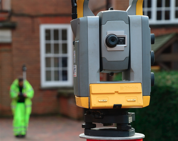
Above : Laser scanner in position.
Completing a Model from the Sky Down
A drone equipped with a high resolution camera is operated over and around the subject, capturing nadir, perpendicular, and oblique images at regular intervals. These images are then stitched together in photogrammetry software to produce a series of outputs, one of which being a colourised point cloud. This can be integrated into the laser scan data, resulting in a single complete point cloud.
The combined output benefits from the precision, accuracy, and penetration of a terrestrial laser scanner, and the manoeuvrability and detail from drone photogrammetry.

Above : Drones in operation carrying out a building photogrammetry survey.
The Final Outputs
This two-pronged approach to surveying amounts to a whole range of 2D and 3D deliverables.
As well as the point clouds, the combined drone photogrammetry and terrestrial laser scan survey can produce:
A digital 3D model, providing a record of the building or structure and enabling the viewer to visualise it remotely (photogrammetry).
Orthographic photos of the roof and elevations, accurately scaled and projected against the laser scan data. These high resolution composite images are instrumental for building recording and documenting its condition (photogrammetry aided by laser scanning).
A BIM model, offering a digital recreation of a building or structure to varying degrees of detail (laser scan and/or photogrammetry).
CAD drawings of the roof and elevations based off the point cloud and orthophotos (laser scan and/or photogrammetry).
Line drawings or stone-by-stone drawings based off of the orthophotos (photogrammetry).
Full photographic record (photogrammetry).
Above : Digital 3D model produced from drone photogrammetry.

Above : Orthographic elevation produced from drone photogrammetry.

Above : Roof plan based off drone photogrammetry data.

Above : CAD drawing of the elevations, based off laser scan and drone photogrammetry data.