Traditional Land Surveying vs. Drone Surveys: Pros and Cons
- May 12, 2025
- 5 min read
In today’s rapidly evolving world of technology, the age-old practice of land surveying has seen significant advancements. Traditional land surveying methods have long been the gold standard, but drones have quickly become a game-changer in the industry. If you’re wondering which method is best for your project, understanding the pros and cons of each approach is essential. In this guide, we'll delve into the nuances of traditional land surveying and drone surveys, helping you make an informed decision.
Traditional Land Surveying
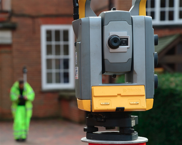
Definition and Techniques Used in Manual Land Surveying
Traditional land surveying involves the use of specialised equipment and methodologies to measure and map the physical environment. Techniques such as triangulation, traverse, and levelling are commonly employed by land surveyors to establish property boundaries, create topographical maps, and ensure accurate data collection.

Pros of Traditional Land Surveying
High Accuracy in Specific Conditions
One of the most significant advantages of traditional land surveying is its ability to deliver high accuracy, especially in specific conditions. When detailed measurements are required, traditional methods excel due to their precise data collection capabilities.
Proven Reliability and Established Methodologies
Traditional surveying has been refined over centuries, making it a reliable choice for projects requiring tried-and-tested methods. Surveyors use well-established procedures that have been honed over time, ensuring consistent results.
Detailed Data Collection Capabilities
Traditional land surveys allow for the collection of highly detailed data. Surveyors can meticulously map out features and provide a comprehensive view of the land, which is particularly beneficial for complex projects.
Cons of Traditional Land Surveying
Time-Consuming Process
Despite its accuracy, traditional land surveying can be time-consuming. The need for manual data collection, often in challenging environments, can slow down the overall process, leading to longer project timelines.
Accessibility Challenges in Difficult Terrains
Surveyors often face difficulties accessing certain terrains, such as dense forests, steep slopes, or hazardous areas. These challenges can impede progress and result in incomplete or delayed surveys.
Drone Surveys
Definition and Techniques Used in Drone Surveys
Drone surveys, also known as UAS (Unmanned Aerial System) surveys, involve the use of drones equipped with high-resolution cameras and GPS technology to capture aerial images of the land. These images are then processed to generate accurate maps, 3D models, and other critical data.

Pros of Drone Surveys
Speed and Efficiency in Data Collection
One of the most significant advantages of drone surveys is their speed and efficiency. Drones can cover large areas quickly, reducing the time required for data collection compared to traditional methods.
Ability to Survey Large and Difficult-to-Access Areas
Drones can easily access and survey areas that are challenging for humans, such as rugged terrains, remote locations, or hazardous sites. This ability allows for comprehensive data collection without putting surveyors at risk.
High-Resolution Imagery and Advanced Data Analytics
Drones are equipped with advanced cameras that capture high-resolution images, providing detailed visual data. Combined with sophisticated software, these images can be processed into accurate maps, 3D models, and other useful outputs.
Cons of Drone Surveys
Regulatory Restrictions and Compliance Issues
Drone surveys are subject to strict regulatory requirements. Operators must comply with laws governing drone usage, which can vary by location and may restrict where and how drones can be used.
Weather Dependency
Drones are highly dependent on weather conditions. Wind, rain, and poor visibility can all affect a drone's ability to capture accurate data, potentially leading to delays or the need for repeat surveys.

Comparing Accuracy and Precision
When it comes to accuracy, both traditional and drone surveys have their strengths. Traditional surveying is highly accurate for specific tasks, particularly in small or detailed areas. On the other hand, drone surveys provide precise data across large areas quickly, making them ideal for broader surveys. The accuracy of land surveying drone results has improved significantly in recent years, with many projects achieving similar levels of precision to traditional methods.
Cost Considerations
Cost is a critical factor when choosing between traditional land surveying and drone surveys. Traditional methods often require more labour, time, and equipment, leading to higher costs, particularly for large or complex projects. In contrast, drone surveys can be more cost-effective, especially for surveying extensive areas, as they reduce the need for on-the-ground personnel and equipment.
Choosing the Right Method for Your Project
The choice between traditional land surveying and drone surveys depends on various factors, including project size, terrain, budget, and specific requirements. For projects requiring detailed measurements in small areas, traditional surveying may be the better choice. However, if you need to survey large, difficult-to-access, or hazardous areas quickly, drone surveys offer significant advantages.
Case Studies and Examples
For instance, a recent infrastructure project utilised drone surveys to map out a large, mountainous area. The drones completed the survey in a fraction of the time it would have taken using traditional methods, providing high-resolution imagery that was crucial for the project's planning phase. Conversely, a small urban development project opted for traditional surveying to ensure precise boundary measurements, demonstrating the value of traditional methods in specific scenarios.
FAQs
What is the difference between drone survey and land survey?
Traditional land surveys use manual techniques, while drone surveys utilise UAS and advanced technology for efficient data collection.
What type of land survey is most accurate?
Traditional surveying is often preferred for its high accuracy in specific, detailed areas, though drones can provide comparable accuracy over large expanses.
What are the advantages of drone surveying over traditional surveying?
Drone surveys offer speed, efficiency, the ability to cover large areas, and high-resolution imagery, making them ideal for broad, challenging terrains.
What are the disadvantages of drone mapping?
Drone mapping is subject to regulatory restrictions, potential technical malfunctions, and weather dependencies, which can impact survey quality.
What are the advantages of a land use survey?
Land use surveys provide valuable insights into how land is being utilised, helping in planning, development, and environmental management.
Why choose land surveying?
Land surveying ensures accurate mapping of land features, property boundaries, and topography, essential for any construction, development, or planning project.
Wrapping It All Up: Which Surveying Method Wins?
Both traditional land surveying and drone surveys have their unique advantages and limitations. Traditional methods offer proven reliability and detailed data, while drone surveys provide speed, efficiency, and the ability to cover large areas. The best approach depends on your project's specific needs, terrain, and budget. Understanding the pros and cons of each method will help you make an informed decision that ensures the success of your project.
Take the Next Step: Get Expert Surveying Advice Today
Need help deciding which surveying method is right for your project?
Our team operates country-wide so if you need a survey, simply request a quotation. We are also more than happy to answer any questions about our services.