We are your eye in the sky. Our latest aerial mapping technology captures data from above
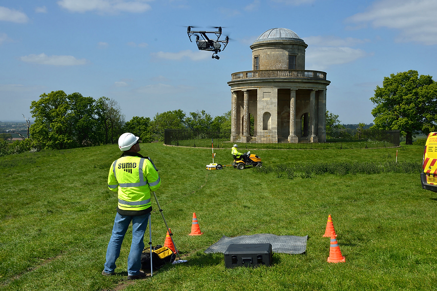
We redefine precision in land surveying. Our method involves providing complete coverage over your survey area. Our UAS equipped with a multispectral camera captures data beyond the visible spectrum. This helps assess plant health and sub-surface features, even in densely vegetated areas. The resulting images are processed to create point clouds, 3D models, Digital Elevation Models, and orthophotographs.
![stars.png](https://static.wixstatic.com/media/eb7905_353415c11c2449689339946e8d1b4720~mv2.png/v1/fill/w_103,h_28,al_c,q_85,usm_0.66_1.00_0.01,enc_avif,quality_auto/stars.png)
Rating of 5.0 based on 80+ Happy Reviews
Drone Surveys
At Sumo Services, we can survey otherwise impractical and challenging sites safely from above. Using the latest technology including Unmanned Aerial Systems (UAS), also known as drones, as well as mobile telescopic masts and piloted aircraft, we can capture images and data safely and accurately.
![ContactUsStar.png](https://static.wixstatic.com/media/eb7905_20c4d5615e264c54a47550c285357991~mv2.png/v1/fill/w_189,h_186,al_c,q_85,usm_0.66_1.00_0.01,enc_avif,quality_auto/ContactUsStar.png)
Your Survey Provider
Our survey teams are strategically located throughout the UK covering a wide range of underground detection surveys.
The SUMO Group is a multi-disciplinary survey business and is committed to maintaining the highest possible standards in all aspects of surveying. Whatever service you use, we pride ourselves on providing a survey that you can truly rely on.
![ExpertiseIcon.png](https://static.wixstatic.com/media/eb7905_2f064ee2cdf9449b8644c2ded9134e17~mv2.png/v1/fill/w_112,h_113,al_c,q_85,usm_0.66_1.00_0.01,enc_avif,quality_auto/ExpertiseIcon.png)
Expertise
on-demand
With surveyors stationed throughout the country, we offer a fast on-demand service wherever and whenever you need us.
![TailoredSolutionsIcon.png](https://static.wixstatic.com/media/eb7905_4d12a348257a4f88aa72d939f209d30f~mv2.png/v1/fill/w_112,h_113,al_c,q_85,usm_0.66_1.00_0.01,enc_avif,quality_auto/TailoredSolutionsIcon.png)
Tailored
Solutions
We work closely with you to understand your survey requirements, ensuring that you receive the quality and detail you expect.
![DrawingIcon.png](https://static.wixstatic.com/media/eb7905_071dcee23f204097aa87f05ba33af37b~mv2.png/v1/fill/w_112,h_113,al_c,q_85,usm_0.66_1.00_0.01,enc_avif,quality_auto/DrawingIcon.png)
Unmatched
Quality
SUMO prides itself on delivering the industry's best survey drawings. They come fully colour-coded as standard and are available in both hard and electronic copy formats.
Nationwide
reach
SUMO operates a network of 30 fully equipped survey teams located throughout the UK. Call us now on 02392 456 282.
![GlobeIcon.png](https://static.wixstatic.com/media/eb7905_f1b37ce10cdc42ec8687c82bc4011615~mv2.png/v1/fill/w_112,h_113,al_c,q_85,usm_0.66_1.00_0.01,enc_avif,quality_auto/GlobeIcon.png)
What’s Included in Drone Aerial Survey Service
-
How accurate is SUMO's underground utility survey and what types of utilities can it locate?Using cutting-edge technologies like electro-magnetics, signal induced threading, and Ground-Penetrating Radar (GPR), our underground utility surveys accurately detect a wide array of buried utilities including metal and plastic pipes, drainage systems, electricity cables, telecoms, and fiber optic cables. The methodology ensures high accuracy without the need for invasive trial holes.
-
What is the turnaround time for obtaining results with SUMO's Underground Utility Detection service?SUMO’s service is built for rapid response. Contractors can receive immediate results onsite. Our equipment provides real-time information, and once we leave the site, the detected utilities are visibly marked on the ground surface for quick reference.
-
Does SUMO provide detailed mapping of the detected utilities for permanent records or construction purposes?Absolutely, SUMO not only marks the detected utilities on-site but also offers high-quality, color-coded survey drawings. These drawings can include topographic features and a comprehensive record of the utility detection survey, ensuring it meets the client’s needs for future reference or pre-construction design works.
-
Topographical and Geophysical surveyIn addition to mapping out utilities, our experience team can accurately survey the land, creating topographical drawings for use. With our state-of-the-art aerial technology, nothing is missed.
-
What additional information can be included in the underground utility mapping service provided by SUMO?In addition to topographic features, SUMO’s mapping service can include fixed surface utility features such as inspection chambers, valve boxes, and telegraph poles. It can also incorporate key topographic details like building lines, fence lines, kerb lines, street furniture, street names, building names, and house numbers, facilitating easy site location.
-
Does the utility mapping service by SUMO include standard referencing and compatibility with existing survey data?Yes, SUMO ensures the utility mapping references the ordnance survey grid and level datum as standard. Additionally, the drawings can be supplied to a specified grid and level datum and can overlay an existing topographical survey, making it a versatile and adaptable service for various project needs.
-
What sets SUMO Services apart from other survey providers?SUMO stands out due to our impeccable level of service with nationwide coverage, state-of-the-art equipment, and our commitment to delivering top-quality, detailed colour-coded survey drawings in both hard and electronic formats.
-
How do I request a survey quotation from SUMO Services?Requesting a quotation is easy. Just click on the "Request a Survey Quotation" button on this page, and our team will get in touch with you promptly.
-
Can I book a SUMO Survey online?Yes, you can! Simply click on the "Book a SUMO Survey" button on this page, and you can schedule your survey with us at your convenience.
-
What type of survey is suitable for my project or site?Our experienced team will work with you to determine the most appropriate survey for your specific needs. Contact us, and we'll assist you in making the right choice.
-
Can I obtain both digital and hard copies of survey drawings?Absolutely. We offer the convenience of electronic copies for digital use and hard copies for your records. Just let us know your preference.
-
Do you provide custom survey solutions for unique projects?Yes, we understand that every project is unique. Our team is highly adaptable and can tailor our surveying services to meet your specific requirements.
-
How do I get in touch with SUMO Services for further questions?For any additional questions or inquiries, feel free to contact us through the contact form, and our dedicated team will assist you promptly.
![ArrowBackgroundTransparent.png](https://static.wixstatic.com/media/eb7905_85bea584c8ca4f39bed9a5ec69d37abe~mv2.png/v1/fill/w_490,h_196,al_c,q_85,usm_0.66_1.00_0.01,enc_avif,quality_auto/eb7905_85bea584c8ca4f39bed9a5ec69d37abe~mv2.png)
Experience the Difference in Surveying
-
How accurate is SUMO's underground utility survey and what types of utilities can it locate?Using cutting-edge technologies like electro-magnetics, signal induced threading, and Ground-Penetrating Radar (GPR), our underground utility surveys accurately detect a wide array of buried utilities including metal and plastic pipes, drainage systems, electricity cables, telecoms, and fiber optic cables. The methodology ensures high accuracy without the need for invasive trial holes.
-
What is the turnaround time for obtaining results with SUMO's Underground Utility Detection service?SUMO’s service is built for rapid response. Contractors can receive immediate results onsite. Our equipment provides real-time information, and once we leave the site, the detected utilities are visibly marked on the ground surface for quick reference.
-
Does SUMO provide detailed mapping of the detected utilities for permanent records or construction purposes?Absolutely, SUMO not only marks the detected utilities on-site but also offers high-quality, color-coded survey drawings. These drawings can include topographic features and a comprehensive record of the utility detection survey, ensuring it meets the client’s needs for future reference or pre-construction design works.
-
Topographical and Geophysical surveyIn addition to mapping out utilities, our experience team can accurately survey the land, creating topographical drawings for use. With our state-of-the-art aerial technology, nothing is missed.
-
What additional information can be included in the underground utility mapping service provided by SUMO?In addition to topographic features, SUMO’s mapping service can include fixed surface utility features such as inspection chambers, valve boxes, and telegraph poles. It can also incorporate key topographic details like building lines, fence lines, kerb lines, street furniture, street names, building names, and house numbers, facilitating easy site location.
-
Does the utility mapping service by SUMO include standard referencing and compatibility with existing survey data?Yes, SUMO ensures the utility mapping references the ordnance survey grid and level datum as standard. Additionally, the drawings can be supplied to a specified grid and level datum and can overlay an existing topographical survey, making it a versatile and adaptable service for various project needs.
-
What sets SUMO Services apart from other survey providers?SUMO stands out due to our impeccable level of service with nationwide coverage, state-of-the-art equipment, and our commitment to delivering top-quality, detailed colour-coded survey drawings in both hard and electronic formats.
-
How do I request a survey quotation from SUMO Services?Requesting a quotation is easy. Just click on the "Request a Survey Quotation" button on this page, and our team will get in touch with you promptly.
-
Can I book a SUMO Survey online?Yes, you can! Simply click on the "Book a SUMO Survey" button on this page, and you can schedule your survey with us at your convenience.
-
What type of survey is suitable for my project or site?Our experienced team will work with you to determine the most appropriate survey for your specific needs. Contact us, and we'll assist you in making the right choice.
-
Can I obtain both digital and hard copies of survey drawings?Absolutely. We offer the convenience of electronic copies for digital use and hard copies for your records. Just let us know your preference.
-
Do you provide custom survey solutions for unique projects?Yes, we understand that every project is unique. Our team is highly adaptable and can tailor our surveying services to meet your specific requirements.
-
How do I get in touch with SUMO Services for further questions?For any additional questions or inquiries, feel free to contact us through the contact form, and our dedicated team will assist you promptly.
Our outputs include photogrammetry, 3D models, geospatial data (orthophotographs and DEMs), photography, and video, enabling you to gain comprehensive insights into your survey area.
Trusted & Accredited by
![Constructionline](https://static.wixstatic.com/media/eb7905_8ccd19ac8dc64463a5fd4c4159dbae17~mv2.png/v1/fill/w_320,h_234,al_c,q_85,enc_avif,quality_auto/eb7905_8ccd19ac8dc64463a5fd4c4159dbae17~mv2.png)
![GPR](https://static.wixstatic.com/media/eb7905_e8a6da92211a4aaf83366eb79133c4f1~mv2.png/v1/fill/w_320,h_234,al_c,q_85,enc_avif,quality_auto/eb7905_e8a6da92211a4aaf83366eb79133c4f1~mv2.png)
![Worksafe](https://static.wixstatic.com/media/eb7905_bfdf30f352284a44a0e52bf80b74492f~mv2.png/v1/fill/w_320,h_234,al_c,q_85,enc_avif,quality_auto/eb7905_bfdf30f352284a44a0e52bf80b74492f~mv2.png)
![Achillies](https://static.wixstatic.com/media/eb7905_cab227569a0b4725a696cf4d9ee2b400~mv2.png/v1/fill/w_320,h_234,al_c,q_85,enc_avif,quality_auto/eb7905_cab227569a0b4725a696cf4d9ee2b400~mv2.png)
![CHAS](https://static.wixstatic.com/media/eb7905_0b52907cc9c44e93ae7d5727d32027c7~mv2.png/v1/fill/w_320,h_234,al_c,q_85,enc_avif,quality_auto/eb7905_0b52907cc9c44e93ae7d5727d32027c7~mv2.png)
![The-Survey-Association](https://static.wixstatic.com/media/eb7905_052a28840263424eb542fcc771a4a141~mv2.png/v1/fill/w_320,h_234,al_c,q_85,enc_avif,quality_auto/eb7905_052a28840263424eb542fcc771a4a141~mv2.png)
![Screenshot 2024-04-30 at 10.48.12](https://static.wixstatic.com/media/eb7905_7749c1be590f4f0094b1f363ee5196a5~mv2.png/v1/fill/w_320,h_234,al_c,q_85,enc_avif,quality_auto/eb7905_7749c1be590f4f0094b1f363ee5196a5~mv2.png)
![Builders-Profile](https://static.wixstatic.com/media/eb7905_f93f8bf472fc41e396865b40046ec5a3~mv2.png/v1/fill/w_320,h_234,al_c,q_85,enc_avif,quality_auto/eb7905_f93f8bf472fc41e396865b40046ec5a3~mv2.png)
![COMS](https://static.wixstatic.com/media/eb7905_bf150c8aa78a4b32b612c7fc12101d0d~mv2.png/v1/fill/w_320,h_234,al_c,q_85,enc_avif,quality_auto/eb7905_bf150c8aa78a4b32b612c7fc12101d0d~mv2.png)
![Dronesafe](https://static.wixstatic.com/media/eb7905_75cb70bfe7c94183b0e811059abb9ef2~mv2.png/v1/fill/w_320,h_234,al_c,q_85,enc_avif,quality_auto/eb7905_75cb70bfe7c94183b0e811059abb9ef2~mv2.png)
![DronePilot](https://static.wixstatic.com/media/eb7905_34ae4a415c484729af9fa3da0cbf0bdc~mv2.png/v1/fill/w_320,h_234,al_c,q_85,enc_avif,quality_auto/eb7905_34ae4a415c484729af9fa3da0cbf0bdc~mv2.png)
![RISQS](https://static.wixstatic.com/media/eb7905_bb09796ac5f140108a149acfe3c17d30~mv2.png/v1/fill/w_320,h_234,al_c,q_85,enc_avif,quality_auto/eb7905_bb09796ac5f140108a149acfe3c17d30~mv2.png)
![Rail-Forum](https://static.wixstatic.com/media/eb7905_75e951d355f2468bb766fccd2e41c6d1~mv2.png/v1/fill/w_320,h_234,al_c,q_85,enc_avif,quality_auto/eb7905_75e951d355f2468bb766fccd2e41c6d1~mv2.png)
![ARPAS](https://static.wixstatic.com/media/eb7905_c4a6a1ee4f0f468193c21783333f9532~mv2.png/v1/fill/w_320,h_234,al_c,q_85,enc_avif,quality_auto/eb7905_c4a6a1ee4f0f468193c21783333f9532~mv2.png)
![ArrowBackgroundTransparent.png](https://static.wixstatic.com/media/eb7905_85bea584c8ca4f39bed9a5ec69d37abe~mv2.png/v1/fill/w_980,h_392,al_c,q_90,usm_0.66_1.00_0.01,enc_avif,quality_auto/eb7905_85bea584c8ca4f39bed9a5ec69d37abe~mv2.png)
Customer Testimonials
![SpeechMark.png](https://static.wixstatic.com/media/eb7905_cc9a33f1805646d2b7efd1b044bb9e57~mv2.png/v1/fill/w_48,h_40,al_c,q_85,usm_0.66_1.00_0.01,enc_avif,quality_auto/SpeechMark.png)
We found SUMO’s archaeological geophysics survey undertaken swiftly and efficiently. Although fortunately, no archaeological evidence was found, SUMO did identify a previously unknown utility running across the site.
Geoff Brakspear
North Somerset Council
![stars.png](https://static.wixstatic.com/media/eb7905_353415c11c2449689339946e8d1b4720~mv2.png/v1/fill/w_102,h_28,al_c,q_85,usm_0.66_1.00_0.01,enc_avif,quality_auto/stars.png)
![SpeechMark.png](https://static.wixstatic.com/media/eb7905_cc9a33f1805646d2b7efd1b044bb9e57~mv2.png/v1/fill/w_48,h_40,al_c,q_85,usm_0.66_1.00_0.01,enc_avif,quality_auto/SpeechMark.png)
We used SUMO for a geophysical survey at a site in Wiltshire and were very impressed with their efficiency and communication. They were very responsive and completed the site visit and report within 2 weeks of instruction. Many thanks for the service.
David Josephs
Strategic Land Manager, HSL
![stars.png](https://static.wixstatic.com/media/eb7905_353415c11c2449689339946e8d1b4720~mv2.png/v1/fill/w_102,h_28,al_c,q_85,usm_0.66_1.00_0.01,enc_avif,quality_auto/stars.png)
![SpeechMark.png](https://static.wixstatic.com/media/eb7905_cc9a33f1805646d2b7efd1b044bb9e57~mv2.png/v1/fill/w_48,h_40,al_c,q_85,usm_0.66_1.00_0.01,enc_avif,quality_auto/SpeechMark.png)
I was extremely happy with the service I received from SUMO and their Site Engineers on a recent GPR survey undertaken for us. From our initial enquiry through to their site work and delivery their response was both prompt and professional. Thank you.
Justin Galloway
Mildren Construction
![stars.png](https://static.wixstatic.com/media/eb7905_353415c11c2449689339946e8d1b4720~mv2.png/v1/fill/w_102,h_28,al_c,q_85,usm_0.66_1.00_0.01,enc_avif,quality_auto/stars.png)
![SpeechMark.png](https://static.wixstatic.com/media/eb7905_cc9a33f1805646d2b7efd1b044bb9e57~mv2.png/v1/fill/w_48,h_40,al_c,q_85,usm_0.66_1.00_0.01,enc_avif,quality_auto/SpeechMark.png)
I was very impressed with both the speed and accuracy of the survey that SUMO had undertaken for me in quite a challenging site. Staff were courteous, professional and I would have no reservations in employing their services again.
Paul Williams
Dorset Healthcare University
![stars.png](https://static.wixstatic.com/media/eb7905_353415c11c2449689339946e8d1b4720~mv2.png/v1/fill/w_102,h_28,al_c,q_85,usm_0.66_1.00_0.01,enc_avif,quality_auto/stars.png)
Drone Aerial Survey FAQs
For any additional questions or inquiries, feel free to contact us through our contact page, and our dedicated team will assist you promptly.
-
How accurate is SUMO's underground utility survey and what types of utilities can it locate?Using cutting-edge technologies like electro-magnetics, signal induced threading, and Ground-Penetrating Radar (GPR), our underground utility surveys accurately detect a wide array of buried utilities including metal and plastic pipes, drainage systems, electricity cables, telecoms, and fiber optic cables. The methodology ensures high accuracy without the need for invasive trial holes.
-
What is the turnaround time for obtaining results with SUMO's Underground Utility Detection service?SUMO’s service is built for rapid response. Contractors can receive immediate results onsite. Our equipment provides real-time information, and once we leave the site, the detected utilities are visibly marked on the ground surface for quick reference.
-
Does SUMO provide detailed mapping of the detected utilities for permanent records or construction purposes?Absolutely, SUMO not only marks the detected utilities on-site but also offers high-quality, color-coded survey drawings. These drawings can include topographic features and a comprehensive record of the utility detection survey, ensuring it meets the client’s needs for future reference or pre-construction design works.
-
Topographical and Geophysical surveyIn addition to mapping out utilities, our experience team can accurately survey the land, creating topographical drawings for use. With our state-of-the-art aerial technology, nothing is missed.
-
What additional information can be included in the underground utility mapping service provided by SUMO?In addition to topographic features, SUMO’s mapping service can include fixed surface utility features such as inspection chambers, valve boxes, and telegraph poles. It can also incorporate key topographic details like building lines, fence lines, kerb lines, street furniture, street names, building names, and house numbers, facilitating easy site location.
-
Does the utility mapping service by SUMO include standard referencing and compatibility with existing survey data?Yes, SUMO ensures the utility mapping references the ordnance survey grid and level datum as standard. Additionally, the drawings can be supplied to a specified grid and level datum and can overlay an existing topographical survey, making it a versatile and adaptable service for various project needs.
-
What sets SUMO Services apart from other survey providers?SUMO stands out due to our impeccable level of service with nationwide coverage, state-of-the-art equipment, and our commitment to delivering top-quality, detailed colour-coded survey drawings in both hard and electronic formats.
-
How do I request a survey quotation from SUMO Services?Requesting a quotation is easy. Just click on the "Request a Survey Quotation" button on this page, and our team will get in touch with you promptly.
-
Can I book a SUMO Survey online?Yes, you can! Simply click on the "Book a SUMO Survey" button on this page, and you can schedule your survey with us at your convenience.
-
What type of survey is suitable for my project or site?Our experienced team will work with you to determine the most appropriate survey for your specific needs. Contact us, and we'll assist you in making the right choice.
-
Can I obtain both digital and hard copies of survey drawings?Absolutely. We offer the convenience of electronic copies for digital use and hard copies for your records. Just let us know your preference.
-
Do you provide custom survey solutions for unique projects?Yes, we understand that every project is unique. Our team is highly adaptable and can tailor our surveying services to meet your specific requirements.
-
How do I get in touch with SUMO Services for further questions?For any additional questions or inquiries, feel free to contact us through the contact form, and our dedicated team will assist you promptly.
![ArrowBackgroundLong.png](https://static.wixstatic.com/media/eb7905_0eda16367d4a4b52b7f2d751a5c7124f~mv2.png/v1/fill/w_980,h_236,al_c,q_85,usm_0.66_1.00_0.01,enc_avif,quality_auto/eb7905_0eda16367d4a4b52b7f2d751a5c7124f~mv2.png)
Please Contact Us
02392 456 282
BRADFORD
West Yorkshire
CHESSINGTON
Surrey
HAVANT
Hampshire
ST. AUSTELL
Cornwall
ECKINGTON
Worcester
WALTHAM ABBEY
London
![ArrowBackground(Black).png](https://static.wixstatic.com/media/eb7905_9880759883af4f4aa66c8b870f48bda2~mv2.png/v1/fill/w_969,h_233,al_c,q_85,usm_0.66_1.00_0.01,enc_avif,quality_auto/eb7905_9880759883af4f4aa66c8b870f48bda2~mv2.png)
Other Services We Offer
Aerial Surveys | Archaeological Surveys | Geophysical Engineering | Laser Scanning & 3D Surveys | Measured Building
Rail Surveys | Topographic Surveys | Utility Surveys
©2024 SUMO Services | Visit Main Website | Privacy Policy | Contact Us |