Why Surveying Without Drones Is Limiting Your Project's Potential
- May 29, 2025
- 5 min read
The construction and land development industries are constantly evolving, and so are the tools we use to measure, map, and manage land. One of the most transformative advances in recent years has been the integration of drone technology into land surveying. If you're still relying solely on traditional surveying methods, you may be missing out on faster data collection, improved accuracy, and valuable insights that can significantly enhance your project outcomes.
At SUMO Services, we harness cutting-edge drone technology to deliver accurate, high-resolution data for sites of all sizes across the UK. In this blog, we explore why surveying without drones could be holding your project back and how embracing this modern approach can give you a real competitive edge.
The Evolution of Surveying Technology
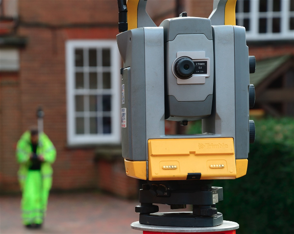
Traditional land surveying has long relied on tools like total stations & GPS receivers —methods that remain reliable, but often limited by ground-level perspective and slower data capture. As projects become more complex and demand higher efficiency, the industry has had to adapt.
The introduction of UAVs (Unmanned Aerial Vehicles), or drones, into the surveying world has revolutionised how we gather geospatial information. Drones can now capture vast amounts of data in a fraction of the time and from angles that were once impossible without expensive aircraft or lengthy fieldwork.

How Drones Have Transformed Land Surveying
Drones have fundamentally changed the way surveyors approach a site. By flying over a location and capturing aerial imagery and LiDAR or photogrammetric data, drones can generate:
3D terrain models
Orthophotos (accurate overhead images)
Digital Elevation Models (DEMs)
Volumetric measurements
Progress tracking and site condition reports
This aerial perspective reduces time spent on-site, improves safety (especially in hazardous or hard-to-reach areas), and creates highly accurate, real-time visualisations that can be shared across project teams.
Key Benefits of Drone Surveying for Your Project
Speed and EfficiencyDrone surveys can cover large areas in minutes—what might take a full day using traditional methods can often be done in few hours or less.
High AccuracyWith the right equipment and processing software, drones deliver precise spatial data that meets or exceeds the standards required for planning and construction.
Cost SavingsFaster data collection means reduced labour costs, fewer site visits, and quicker decision-making—all contributing to reduced overall project costs.
Improved SafetySurveying steep slopes, construction zones, or unstable ground can be dangerous. Drones allow surveyors to capture necessary data without setting foot in risky areas.
Better Collaboration3D models and aerial imagery provide clear visuals that help stakeholders—from architects to contractors, understand the site instantly and make faster decisions.
VersatilityDrone surveys are useful at every stage of a project, from pre-planning and environmental assessments to construction monitoring and final inspections.
Who Can Carry Out a Drone Survey?
In the UK, drone surveys must be conducted by qualified professionals with the proper certifications. At a minimum, drone operators should hold:
A General Visual Line of Sight Certificate (GVC) or equivalent
An Operational Authorisation from the Civil Aviation Authority (CAA)
Appropriate insurance, including public liability and professional indemnity
Experience in land surveying, mapping, or geospatial data analysis
At SUMO Services, our drone surveys are carried out by fully licensed UAV pilots who also have a background in surveying, ensuring that the data captured is not only accurate but useful in real-world applications.
What can be Included in a Drone Survey?
A comprehensive drone survey typically can include:
Aerial photography and video of the site
Orthomosaic maps stitched from high-resolution images
3D digital terrain or surface models
Contours and elevation data
Volume calculations (e.g., stockpile measurements)
Georeferenced data for integration with CAD or GIS systems
Annotated site progress images (for ongoing construction or asset tracking)
Deliverables can be tailored depending on your project needs, from simple site imagery to detailed 3D BIM-compatible outputs.

Why Are Drone Surveys Needed?
Drone surveys aren’t just a "nice to have", they’re often the smarter choice when time, accuracy, and budget matter. They're particularly valuable for:
Large, open, or rural sites
Sites with difficult access or safety risks
Projects requiring regular progress tracking
Environmental assessments and flood risk analysis
Pre-construction planning and feasibility studies
By choosing drone surveying, you're equipping your project with faster insights, better data, and a clear visual record, right from the start.
Unlock Your Project's Potential with SUMO Services
At SUMO Services, we combine traditional surveying expertise with cutting-edge drone technology to deliver actionable data that enhances every stage of your project. From planning applications and topographical mapping to site inspections and asset management, we help you get more value from your land.
FAQs
1. Are drone surveys accurate enough for construction planning?
Yes, when carried out by qualified professionals using high-resolution sensors and accurate georeferencing, drone surveys can meet or exceed the accuracy needed for planning, design, and construction. At SUMO Services, we ensure all drone data is processed to industry-standard tolerances.
2. Do drone surveys replace traditional land surveys?
Not entirely. Drone surveys are a powerful complement to traditional methods, especially for large or hard-to-reach sites. They enhance topographic mapping, progress monitoring, and visual inspection, but boundary verification or underground utilities may still require ground-based equipment.
3. How long does a drone survey take?
Most drone surveys can be completed in a matter of hours, depending on the size and complexity of the site. The full results, including processed data and visual outputs, are usually delivered within a few working days.
4. Is special permission needed to fly drones for surveying in the UK?
Yes. Drone operators must be certified by the Civil Aviation Authority (CAA) and operate under a General Visual Line of Sight Certificate (GVC) or equivalent. At SUMO Services, our drone pilots are fully licensed, insured, and operate legally in all survey environments.
5. What types of sites benefit most from drone surveys?
Drone surveys are ideal for large open spaces, infrastructure corridors, construction zones, rural land, and areas that are unsafe or inefficient to access on foot. They're also beneficial for projects needing regular progress tracking or volumetric analysis.
6. What do I receive from a drone survey?
Typical deliverables include orthomosaic imagery, 3D models, elevation data, contour lines, volume calculations, and high-resolution aerial photography. These outputs can be provided in formats compatible with CAD, GIS, and BIM systems.
Arrange For A Land Survey With SUMO Services
At SUMO Services, we provide many different surveys to match the specific requirements of different projects: large or small. We quote our surveys based on project-by-project basis as the complexity of the survey, the difficulty of the terrain and the depth of detail needed all factor into the time spent. We provide free quotations to give you a good starting point.