What Is the Importance of Topographic Maps for Architects?
- Jun 11, 2025
- 6 min read
Before any structure is built, the land must first be understood. For architects, that understanding begins with a detailed topographic map. At SUMO Services, we specialise in providing accurate, high-quality topographical surveys across the UK, giving architects and design teams the critical data they need to create informed, efficient, and buildable designs.
A topographical map is often the first and most important step in turning a vision into reality. In this blog, we’ll explain what topographic maps are, how they’re made, and why they’re such an essential tool for architects, planners, and construction professionals alike.
What are Topographic Maps?
A topographic map represents the three-dimensional features of a piece of land on a two-dimensional surface. It captures the site's shape, elevation, contours, and key physical and man-made features.
This detailed snapshot provides architects with a comprehensive understanding of the site, allowing them to design with precision and foresight.
A quality topographic map includes:
Contour lines showing land elevation and slope
Natural features such as trees, rivers, ditches, and embankments
Man-made structures like buildings, roads, paths, fences, and walls
Drainage features including gullies, culverts, and ditches
Boundaries and access points
Services and utilities when combined with underground mapping (e.g. PAS 128)
By understanding what already exists on a site, architects can avoid surprises later in the design or build process.

How Does Understanding the Landscape Help with Planning?
Understanding the lay of the land undoubtedly is important in the early stages of construction. Detailed surveys reveal much of the land that only experienced and well-equipped surveyors can uncover. Topographic maps provide an informed insight that are of interest to the land owner as well as the architects responsible for turning a vision into a reality.
Here are some reasons why architects benefit from topographic maps:
1. Informed Site Planning
Before a single line is drawn on the blueprint, architects need a clear understanding of the site's existing conditions. A topographic map reveals variations in ground level, drainage paths, vegetation, boundaries, and existing infrastructure—critical details that can influence everything from building orientation to foundational requirements.
2. Design Accuracy and Feasibility
By incorporating accurate topographic data, architects can design structures that work with the landscape, not against it. This reduces the risk of costly changes during construction and ensures compliance with planning and environmental regulations.
3. Optimised Earthworks and Drainage
Understanding elevation and slope helps architects and engineers design efficient drainage systems and plan necessary cut-and-fill operations. This is particularly important for sustainable site development and long-term structural integrity.
4. Risk Mitigation
Topographic surveys help identify potential site challenges, such as uneven terrain or proximity to flood zones, before they become costly problems. This allows architects to adapt their designs early in the process, avoiding delays and unplanned expenses.
5. Planning and Compliance
Accurate topographic data supports planning applications by providing local authorities with reliable site information, helping to reduce approval delays. This includes determining the access routes, land boundaries and any potential interruption to public rights of way.
How are Topographic Maps Made?

At SUMO Services, we use a combination of cutting-edge surveying technology and industry expertise to produce accurate topographic data. Here’s how we do it:
Initial Site Visit & Control PointsWe establish geospatial control points to ensure all data is measured accurately to national grid references and levels.
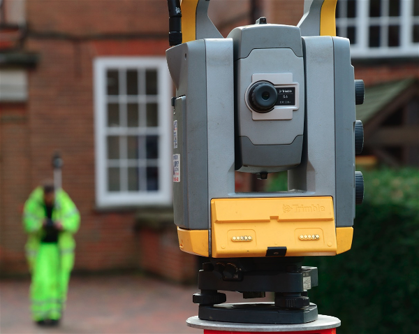
Data Collection Using Total Stations & GPSUsing high-precision total stations, GNSS (GPS) equipment, we capture detailed data points across the site.
Drone SurveysFor larger or complex sites, we supplement ground data with aerial drone surveys to quickly capture terrain from above, quickly and cost-effectively.
Processing & DraftingOur surveyors process the data using CAD and specialist software, generating a topographic map that includes all relevant site features with contours, spot levels, and annotations.
Customisation for Project NeedsWe tailor each map to the needs of the architect or engineer, whether it’s for residential housing, commercial development, or infrastructure planning.
How Much Does a Topographic Survey Cost?
The cost of a topographic survey in the UK can vary depending on the size, complexity, and location of the site, as well as the level of detail required. For a small residential plot, such as a garden or single dwelling, the cost can typically range up to £900. Medium-sized sites, like small commercial developments or housing plots, can cost between £900 and £2,000. For larger or more complex sites, especially those with challenging terrain or a high number of features, costs can start from £2,000 and go upward.
Several factors influence pricing, including the physical size of the site, the complexity and number of natural and built features, access limitations, and whether any additional services are required, such as utility mapping, 3D modelling, or high-resolution deliverables in formats like CAD, or Revit. The location of the site can also impact the final quote, especially if travel or overnight stays are needed.
SUMO provide quick and accurate quotations, as the above can only be used as a guide due to the uniqueness of each project.
How Long Does a Topographic Survey Take?

The time it takes to complete a topographic survey also depends on the scope of the project. For a small site, the fieldwork can usually be completed in a single day, with drawings and deliverables provided within 1 to 3 working days, depending on current commitments.
Medium-sized sites may require 1 to 2 days on-site, with final results typically delivered in 5 - 10 working days. Larger or more detailed projects may require several days on-site and up to one to two weeks for full processing, quality control, and drawing production.
Other factors can influence the timeline, including weather conditions (especially for drone or laser scanning), the level of detail requested, and whether the survey includes additional services like PAS 128 utility mapping. Many professional surveying firms also offer fast-track or priority services for urgent projects, as well as combined survey packages to reduce time and cost.
Who Arranges for A Topographic Survey: Architect or Land Owner?
In most cases, either the architect or the landowner can arrange for a topographic survey. It depends on the structure of the project and who is responsible for coordinating early-stage planning.
Architect-led projects:
If an architect is brought in early, especially on more complex or bespoke developments, they will often recommend and sometimes organise the topographic survey as part of their design brief. They may have preferred survey partners or coordinate it to ensure the results meet their design needs.
Landowner or developer-led projects:
On smaller residential projects or where the owner is managing the process, the landowner or developer may arrange the survey themselves, often at the recommendation of a planning consultant, builder, or architect.
Design & build or contractor-led projects:
In these scenarios, where a contractor manages both design and construction, the contractor or their in-house team usually takes responsibility for commissioning the survey early on.
FAQs
Why are topographic maps important for architects?
Topographic maps provide detailed information about the natural and man-made features of a site, including elevation, slopes, and terrain contours. This data helps architects design structures that harmonise with the environment and meet safety and functional requirements.
How do topographic maps assist in site analysis?
Topographic maps help architects evaluate site conditions such as elevation changes, drainage patterns, and potential obstacles. This analysis is essential for determining the best placement of buildings, utilities, and access points while mitigating environmental risks.
Can topographic maps influence the design process?
Yes! Architects use topographic maps to adapt designs to the natural landscape, reducing excavation and building costs. By considering elevation and slope, they can create structures that blend seamlessly into their surroundings and maximise the use of the site.
Are topographic maps necessary for construction planning?
Absolutely. These maps guide construction teams by providing accurate information about the site's terrain. This helps in planning excavation, drainage systems, foundation placement, and overall site development, ensuring the project progresses smoothly and efficiently.
How does the accuracy of a topographic map impact architectural projects?
Accurate topographic maps reduce the risk of errors during design and construction. They ensure architects have precise data for creating designs that account for site conditions, preventing costly adjustments and delays during construction.
What tools or technologies are used to create topographic maps?
Modern topographic maps are often created using advanced technologies like GPS, drones, and GIS software. These tools provide highly detailed and precise data, enabling architects to work with the most reliable site information.
Arrange For A Topographic Survey With SUMO Services
All projects start here: mapping out the landscape and planning what to do with it. At SUMO Services, we provide many different surveys to match the specific requirements of different projects: large or small.
We quote our surveys based on project-by-project basis as the complexity of the survey, the difficulty of the terrain and the depth of detail needed all factor into the time spent. We provide free quotations to give you a good starting point.