The Ultimate Guide to PAS 128 Surveys: Standards, Methods, and Applications
- May 29, 2025
- 6 min read
In the realm of construction and infrastructure development, understanding the location of underground utilities is paramount. Striking a hidden cable or pipe can lead to costly delays, safety hazards, and legal complications. To mitigate these risks, the British Standards Institution introduced PAS 128, a specification that standardises the process of underground utility detection. This guide delves into the intricacies of PAS 128 surveys, elucidating their significance, methodologies, and applications.
What Does PAS 128 Stand For?
PAS 128 stands for "Publicly Available Specification 128," a standard developed by the British Standards Institution (BSI) in collaboration with industry experts. It provides a structured approach to the detection, verification, and location of underground utilities, ensuring consistency and reliability in survey results.
Understanding the PAS 128 Specification
The PAS 128 specification outlines the requirements for conducting utility surveys, categorising them into four types (A to D) based on the methods employed and the confidence level in the results. It also introduces Quality Levels (QLs) to indicate the accuracy of the detected utilities. By adhering to this standard, surveyors can deliver consistent and dependable data, facilitating informed decision-making in construction projects.
What Is a PAS 128 Survey?
A PAS 128 survey is a systematic process of detecting and mapping underground utilities in accordance with the PAS 128 standard. It involves various techniques, including desktop research, site reconnaissance, geophysical detection, and physical verification, to identify the presence and position of buried services. The survey's comprehensiveness and accuracy depend on the chosen survey type and the methodologies applied.
Why Is a PAS 128 Survey Needed?
Conducting a PAS 128 survey is crucial for several reasons:
Risk Mitigation: By accurately locating underground utilities, the survey helps prevent accidental strikes during excavation, reducing the risk of injuries and service disruptions.
Cost Efficiency: Identifying utilities beforehand minimises unexpected delays and associated costs in construction projects.
Regulatory Compliance: Adhering to PAS 128 demonstrates a commitment to industry best practices and safety standards.
Informed Planning: Reliable utility data enables better design and planning decisions, enhancing project outcomes

Why PAS 128 Surveys Matter in Utility Detection
PAS 128 surveys provide a benchmark for quality and accuracy in utility detection. They offer a transparent framework that clients and contractors can rely on, ensuring that the data collected meets specific requirements. This standardisation fosters trust among stakeholders and promotes safer, more efficient construction practices
Classification Levels and Survey Types in PAS 128
PAS 128 categorises surveys into four types
Type D: Desktop utility records search, involving the collection of existing utility data from records.
Type C: Site reconnaissance, where surveyors validate record data through visual inspection of physical features
Type B: Detection using geophysical methods like Ground Penetrating Radar (GPR) and Electromagnetic Locators (EML) to locate utilities.
Type A: Verification through physical exposure of utilities via excavation or inspection chambers.
Each type offers varying levels of confidence and accuracy, with Type A providing the highest assurance.
Exploring PAS 128 Survey Category Type B
Type B surveys are pivotal in utility detection, employing non-invasive geophysical techniques to locate underground services. These surveys are further classified into Quality Levels B1 to B4, indicating the confidence in the detected utilities' position and depth. Type B surveys strike a balance between accuracy and practicality, making them a popular choice in many projects.
PAS 128 Quality Levels Explained
Quality Levels (QLs) in PAS 128 denote the reliability of the utility data:
QL-D: Based solely on desktop records, offering the lowest confidence level.
QL-C: Combines records with site reconnaissance, providing moderate confidence.
QL-B4 to QL-B1: Derived from geophysical detection, with QL-B1 indicating the highest confidence in both position and depth.
QL-A: Achieved through physical verification, offering the utmost accuracy.
These levels guide stakeholders in assessing the reliability of the survey data for decision-making.
Common Methods Used in PAS 128 Surveys
PAS 128 surveys utilise a combination of techniques to detect underground utilities:
Ground Penetrating Radar (GPR): Emits radar pulses to identify subsurface anomalies.
Electromagnetic Locators (EML): Detects electromagnetic fields emitted by metallic utilities.
Visual Inspection: Involves examining surface features and utility markers.
Vacuum Excavation: Non-destructive method to expose utilities for verification.
The choice of methods depends on the project's requirements and the desired Quality Level.
The Role of Ground Penetrating Radar (GPR) in PAS 128
GPR plays a crucial role in Type B surveys, offering a non-invasive means to detect non-metallic and metallic utilities. It provides valuable data on the depth and position of subsurface features, enhancing the accuracy of the survey. However, GPR's effectiveness can be influenced by soil conditions and the presence of moisture.
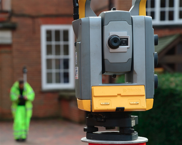
Tools and Technologies for Underground Utility Detection
PAS 128 surveys leverage a suite of advanced tools to ensure precise detection and mapping of underground utilities. Among these, Ground Penetrating Radar (GPR) stands out for its ability to identify both metallic and non-metallic utilities without excavation. Electromagnetic locators (EML) are also commonly used, particularly effective for detecting conductive materials like metal pipes and cables. These technologies, when combined with experienced surveyors' expertise, provide a comprehensive view of the subsurface infrastructure.

Key Applications of PAS 128 in Infrastructure Projects
The implementation of PAS 128 surveys is crucial across various infrastructure projects. In urban development, they help avoid utility strikes during excavation, ensuring public safety and project continuity. For transportation projects, accurate utility mapping prevents costly delays and redesigns. Additionally, utility companies rely on these surveys for maintenance planning and to update their records, enhancing the reliability of their services.
PAS 128 vs. Non-Standard Utility Surveys
While non-standard utility surveys may offer initial cost savings, they often lack the comprehensive methodology and quality assurance of PAS 128 surveys. The absence of standardised procedures can lead to inconsistent data, increasing the risk of utility strikes and project delays. In contrast, PAS 128 surveys provide a clear framework, ensuring high-quality data that supports safe and efficient project execution.
Implementing PAS 128 surveys requires careful planning and consideration. Factors such as site accessibility, ground conditions, and the presence of existing records can impact the survey's effectiveness. Additionally, selecting the appropriate survey type and quality level is crucial to meet the project's specific needs. Engaging experienced professionals who understand these nuances ensures the successful application of PAS 128 standards.
Making PAS 128 Work for Your Project
To maximise the benefits of PAS 128 surveys, it's essential to integrate them early in the project lifecycle. Early detection of underground utilities informs design decisions, reduces the likelihood of costly changes, and enhances overall project safety. Collaborating with qualified surveyors who can tailor the survey approach to your project's unique requirements will ensure accurate and actionable results.
Navigating the Underground with Confidence
Understanding and implementing PAS 128 surveys is vital for any project involving ground disturbance. These surveys provide a reliable framework for detecting and mapping underground utilities, mitigating risks, and ensuring project success. By embracing PAS 128 standards, stakeholders can navigate the complexities of subsurface infrastructure with greater confidence and precision.
FAQs
What is a PAS 128 survey and why is it important?
A PAS 128 survey is a British standard for underground utility detection. It ensures consistent and reliable data collection using clearly defined methods and accuracy levels. This helps reduce risk, improve safety, and support better planning in construction and infrastructure projects.
What are the different PAS 128 survey types?
PAS 128 includes four main survey types: Type D (desktop search), Type C (site reconnaissance), Type B (geophysical detection), and Type A (verification by excavation). Each type offers increasing confidence in the accuracy and location of underground utilities.
When should I use a PAS 128 survey?
PAS 128 surveys are ideal before excavation, utility installations, infrastructure upgrades, or any project involving ground disturbance. They help prevent costly service strikes and ensure compliance with industry best practices.
Who can carry out a PAS 128 survey?
Qualified surveyors with expertise in underground utility detection and the right geophysical tools should carry out PAS 128 surveys. Many organisations work with accredited providers to ensure data accuracy and compliance with the standard.
How accurate are PAS 128 surveys?
Accuracy depends on the survey type and the detection method used. Type B surveys include quality levels (QL-B1 to QL-B4) that indicate confidence in the utility data. This allows project teams to make informed decisions based on reliability.
What are the benefits of PAS 128 over non-standard surveys?
PAS 128 offers a structured and auditable approach, with clearly defined standards and confidence levels. Unlike non-standard surveys, it provides consistency, minimises risk, and improves decision-making throughout the project lifecycle.
Ready to Ensure the Safety and Success of Your Project?
At SUMO Services, we specialise in delivering PAS 128-compliant surveys tailored to your project's unique needs. Our experienced team utilises advanced technologies to provide accurate and reliable underground utility mapping.